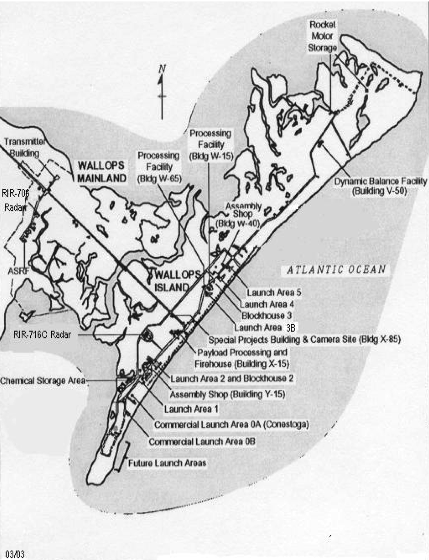
Fichier:Wallops Island map.png
Wallops_Island_map.png (429 × 560 pixels, taille du fichier : 281 kio, type MIME : image/png)
Historique du fichier
Cliquer sur une date et heure pour voir le fichier tel qu'il était à ce moment-là.
| Date et heure | Vignette | Dimensions | Utilisateur | Commentaire | |
|---|---|---|---|---|---|
| actuel | 14 octobre 2006 à 00:54 |  | 429 × 560 (281 kio) | Pengo | Map of w:Wallops Island ==Source== *WFF Customer Guide (PDF), p15 "Version C" ("05/15/2005") *http://www.wff.nasa.gov/multimedia/ ==Original caption== The drawing to the right depicts Wallops Mainland and Wallops Island Research Range launch faci |
Utilisation du fichier
La page suivante utilise ce fichier :
Usage global du fichier
Les autres wikis suivants utilisent ce fichier :
- Utilisation sur gl.wiki.x.io
- Utilisation sur it.wiki.x.io
- Utilisation sur ja.wiki.x.io
- Utilisation sur nl.wiki.x.io
- Utilisation sur pl.wiki.x.io
- Utilisation sur pt.wiki.x.io


