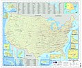
Fichier:U.S. Military Installations Map.jpg

Taille de cet aperçu : 717 × 600 pixels. Autres résolutions : 287 × 240 pixels | 574 × 480 pixels | 918 × 768 pixels | 1 224 × 1 024 pixels | 2 449 × 2 048 pixels | 16 500 × 13 800 pixels.
Fichier d’origine (16 500 × 13 800 pixels, taille du fichier : 52,36 Mio, type MIME : image/jpeg)
Historique du fichier
Cliquer sur une date et heure pour voir le fichier tel qu'il était à ce moment-là.
| Date et heure | Vignette | Dimensions | Utilisateur | Commentaire | |
|---|---|---|---|---|---|
| actuel | 30 juin 2009 à 16:51 |  | 16 500 × 13 800 (52,36 Mio) | Sv1xv | {{Information |Description={{en|1=U.S. Military Installations Map (CONUS). This is a map of the major U.S. military installations in the continental United States. It is used by military and government contacts to assist in Federal communication to state |
Utilisation du fichier
Les 2 pages suivantes utilisent ce fichier :
Usage global du fichier
Les autres wikis suivants utilisent ce fichier :
- Utilisation sur en.wiki.x.io
- Utilisation sur en.wikiquote.org
- Utilisation sur fa.wiki.x.io
- Utilisation sur uk.wiki.x.io
- Utilisation sur zh.wiki.x.io
