Fichier:The Turn Again Stone - geograph.org.uk - 676701.jpg
Pas de plus haute résolution disponible.
The_Turn_Again_Stone_-_geograph.org.uk_-_676701.jpg (640 × 480 pixels, taille du fichier : 189 kio, type MIME : image/jpeg)
Ce fichier et sa description proviennent de Wikimedia Commons.
Description
| Description |
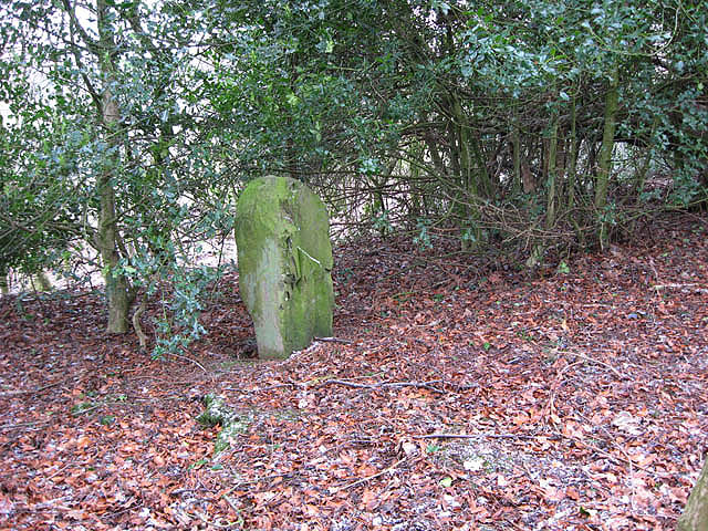
English: The Turn Again Stone This waist-high stone is situated in a narrow strip of woodland to the north of the farm buildings at Kaeside. The stone is believed to have been erected around 1526 following the Battle of Melrose on Skirmish Hill. Ker of Cessford had routed supporters of James V and decided to give chase to the fleeing soldiers. According to folklore, at the spot where the stone stands, Elliot turned and speared Ker to death. |
| Date | |
| Source | From geograph.org.uk |
| Auteur | Walter Baxter |
| Attribution (imposé par la licence) | Walter Baxter / The Turn Again Stone / |
| Lieu de la prise de vue | | Voir cet endroit et d’autres images sur : OpenStreetMap |
|---|
_heading:90.00&language=fr)
| Position de l'objet | | Voir cet endroit et d’autres images sur : OpenStreetMap |
|---|
_heading:90.00&language=fr)
Conditions d’utilisation

|
Cette image provient de la collection du projet Geograph British Isles. Pour obtenir les coordonnées du photographe, veuillez consulter cette page de description de l'image sur le site du projet. Les droits d'auteurs sur cette image sont détenus par Walter Baxter ; l'image est placée sous une licence Creative Commons avec mention de paternité et partage à l'identique (CC-By-SA) en version 2.0.
|
Ce fichier est disponible selon les termes de la licence Creative Commons Attribution – Partage dans les Mêmes Conditions 2.0 Générique
Attribution: Walter Baxter
- Vous êtes libre :
- de partager – de copier, distribuer et transmettre cette œuvre
- d’adapter – de modifier cette œuvre
- Sous les conditions suivantes :
- paternité – Vous devez donner les informations appropriées concernant l'auteur, fournir un lien vers la licence et indiquer si des modifications ont été faites. Vous pouvez faire cela par tout moyen raisonnable, mais en aucune façon suggérant que l’auteur vous soutient ou approuve l’utilisation que vous en faites.
- partage à l’identique – Si vous modifiez, transformez, ou vous basez sur cette œuvre, vous devez distribuer votre contribution sous la même licence ou une licence compatible avec celle de l’original.
Historique du fichier
Cliquer sur une date et heure pour voir le fichier tel qu'il était à ce moment-là.
| Date et heure | Vignette | Dimensions | Utilisateur | Commentaire | |
|---|---|---|---|---|---|
| actuel | 8 février 2011 à 01:37 | | 640 × 480 (189 kio) | GeographBot | == {{int:filedesc}} == {{Information |description={{en|1=The Turn Again Stone This waist-high stone is situated in a narrow strip of woodland to the north of the farm buildings at Kaeside. The stone is believed to have been erected around 1526 following t |
Utilisation du fichier
La page suivante utilise ce fichier :
Usage global du fichier
Les autres wikis suivants utilisent ce fichier :
- Utilisation sur en.wiki.x.io
- Utilisation sur www.wikidata.org