Fichier:Strategic Situation of Europe 1796.jpg
Taille de cet aperçu : 773 × 600 pixels. Autres résolutions : 309 × 240 pixels | 619 × 480 pixels | 990 × 768 pixels | 1 280 × 993 pixels | 1 401 × 1 087 pixels.
Fichier d’origine (1 401 × 1 087 pixels, taille du fichier : 908 kio, type MIME : image/jpeg)
Ce fichier et sa description proviennent de Wikimedia Commons.
Description
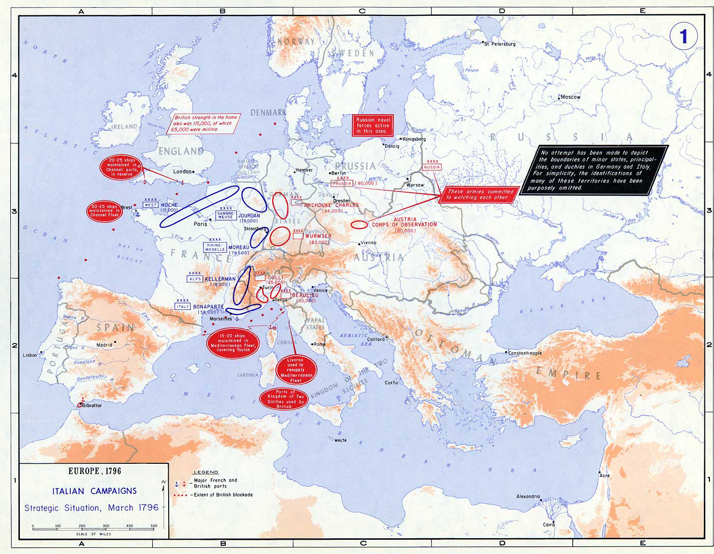
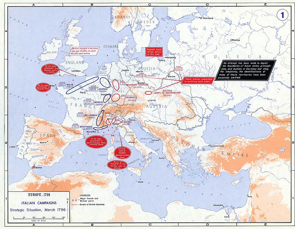
| Description | Strategic Situation of Europe, 1796 |
| Source | The Department of History, United States Military Academy |
| Auteur | United States army |
| Autorisation (Réutilisation de ce fichier) |
In the public domain as an original work of the United States federal government and/or military |
Conditions d’utilisation
Ce média est dans le domaine public des États-Unis d’Amérique car son auteur est l’administration américaine comme précisé dans le code fédéral au Titre 17, Chapitre 1, Section 105. Pour en savoir plus : droit d’auteur.
Attention : Ceci ne concerne que le travail du Gouvernement Fédéral et pas celui des États, ou d’une autre subdivision géographique ou politique du pays.
|
 | |
| Ce fichier a été identifié comme étant exempt de restrictions connues liées au droit d’auteur, y compris tous les droits connexes et voisins. | ||
Historique du fichier
Cliquer sur une date et heure pour voir le fichier tel qu'il était à ce moment-là.
| Date et heure | Vignette | Dimensions | Utilisateur | Commentaire | |
|---|---|---|---|---|---|
| actuel | 3 août 2019 à 19:05 | | 1 401 × 1 087 (908 kio) | Claude Zygiel | 1796 borders according with historic atlases available. |
| 12 avril 2012 à 22:19 |  | 1 401 × 1 087 (226 kio) | Saddhiyama | Reverted to version as of 03:36, 24 December 2006 | |
| 12 janvier 2011 à 19:29 |  | 1 401 × 1 087 (264 kio) | Conveyance | added Neutral Serbian observers | |
| 12 janvier 2011 à 18:05 |  | 1 401 × 1 087 (264 kio) | Conveyance | Mainz added (see: Battle of Mainz). | |
| 24 décembre 2006 à 05:36 |  | 1 401 × 1 087 (226 kio) | Cave cattum | {{Information |Description = Strategic Situation of Europe, 1796 |Source = [http://www.dean.usma.edu/history/web03/atlases/napoleon/napoleon%20war%20index.htm The Department of History, United States Military Academy] |Date = |Author = |Permission = In |
Utilisation du fichier
Les 4 pages suivantes utilisent ce fichier :
Usage global du fichier
Les autres wikis suivants utilisent ce fichier :
- Utilisation sur ast.wiki.x.io
- Utilisation sur azb.wiki.x.io
- Utilisation sur ca.wiki.x.io
- Utilisation sur cs.wiki.x.io
- Utilisation sur de.wiki.x.io
- Utilisation sur el.wiki.x.io
- Utilisation sur en.wiki.x.io
- Utilisation sur es.wiki.x.io
- Utilisation sur et.wiki.x.io
- Utilisation sur it.wiki.x.io
- Utilisation sur ja.wiki.x.io
- Utilisation sur ko.wiki.x.io
- Utilisation sur lt.wiki.x.io
- Utilisation sur ml.wiki.x.io
- Utilisation sur no.wiki.x.io
- Utilisation sur uk.wiki.x.io
- Utilisation sur vi.wiki.x.io
- Utilisation sur zh.wiki.x.io