Fichier:SouthItaly 400BC map.svg

Taille de cet aperçu PNG pour ce fichier SVG : 570 × 599 pixels. Autres résolutions : 228 × 240 pixels | 457 × 480 pixels | 731 × 768 pixels | 974 × 1 024 pixels | 1 948 × 2 048 pixels | 1 350 × 1 419 pixels.
Fichier d’origine (Fichier SVG, nominalement de 1 350 × 1 419 pixels, taille : 2,09 Mio)
Ce fichier et sa description proviennent de Wikimedia Commons.
Description
| Description |
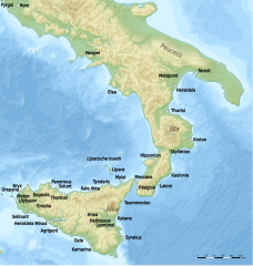
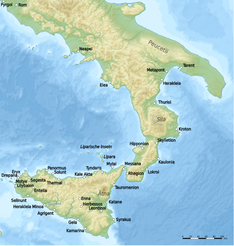
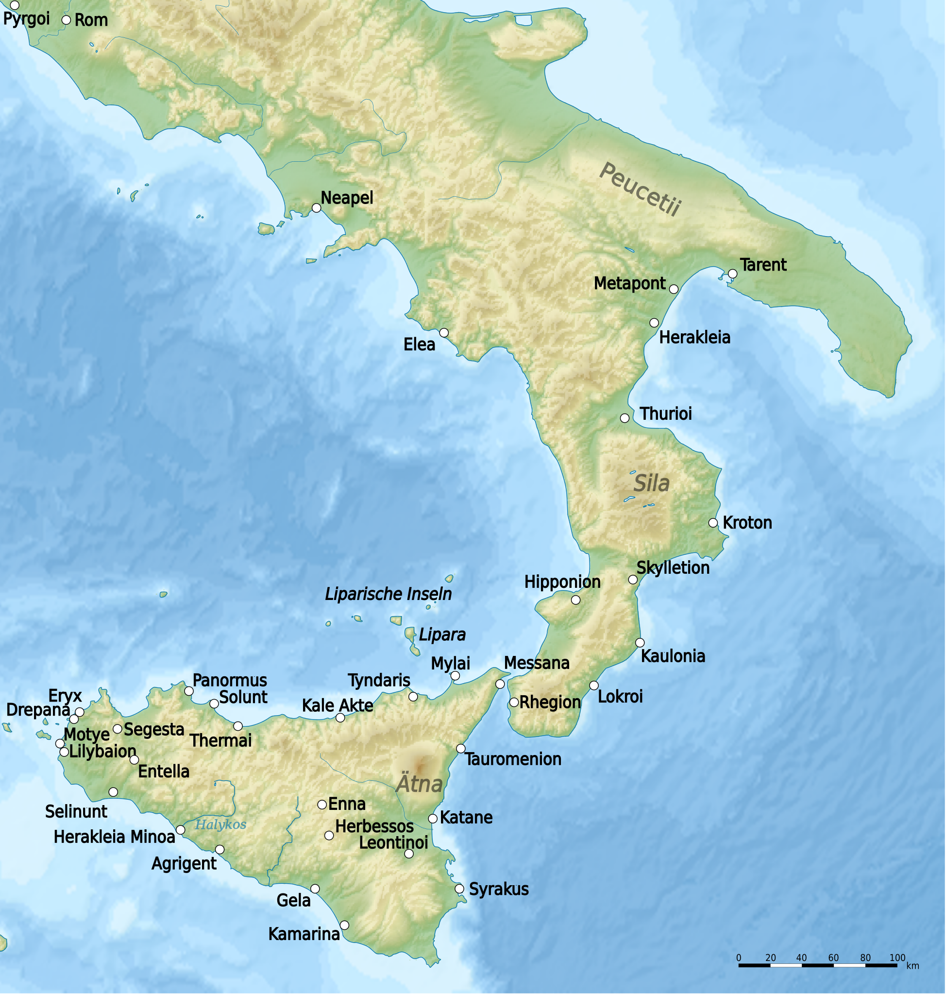
English: Map of South Italy (Grater Greece and Sicily) around 400 B.C. |
| Date | |
| Source | Travail personnel |
| Auteur | Uwe Dedering |
Conditions d’utilisation
Moi, en tant que détenteur des droits d’auteur sur cette œuvre, je la publie sous la licence suivante :
Ce fichier est disponible selon les termes de la licence Creative Commons Attribution – Partage dans les Mêmes Conditions 3.0 (non transposée).
- Vous êtes libre :
- de partager – de copier, distribuer et transmettre cette œuvre
- d’adapter – de modifier cette œuvre
- Sous les conditions suivantes :
- paternité – Vous devez donner les informations appropriées concernant l'auteur, fournir un lien vers la licence et indiquer si des modifications ont été faites. Vous pouvez faire cela par tout moyen raisonnable, mais en aucune façon suggérant que l’auteur vous soutient ou approuve l’utilisation que vous en faites.
- partage à l’identique – Si vous modifiez, transformez, ou vous basez sur cette œuvre, vous devez distribuer votre contribution sous la même licence ou une licence compatible avec celle de l’original.
Historique du fichier
Cliquer sur une date et heure pour voir le fichier tel qu'il était à ce moment-là.
| Date et heure | Vignette | Dimensions | Utilisateur | Commentaire | |
|---|---|---|---|---|---|
| actuel | 11 octobre 2010 à 11:08 | | 1 350 × 1 419 (2,09 Mio) | Uwe Dedering | -himera |
| 30 septembre 2010 à 16:11 |  | 1 350 × 1 419 (2,09 Mio) | Uwe Dedering | Kale Acte | |
| 29 septembre 2010 à 12:39 |  | 1 350 × 1 419 (2,09 Mio) | Uwe Dedering | {{Information |Description={{en|1=Map of South Italy (Grater Greece and Sicily) around 400 B.C.}} |Source={{own}} |Author=Uwe Dedering |Date=2010-09-29 |Permission= |other_versions= }} Category:Maps of Italy |
Utilisation du fichier
La page suivante utilise ce fichier :
Usage global du fichier
Les autres wikis suivants utilisent ce fichier :
- Utilisation sur als.wiki.x.io
- Utilisation sur de.wiki.x.io
- Utilisation sur et.wiki.x.io
- Utilisation sur hu.wiki.x.io
- Utilisation sur it.wiki.x.io
- Utilisation sur nl.wiki.x.io
- Utilisation sur ru.wiki.x.io
- Utilisation sur uk.wiki.x.io