Fichier:SouthAntrimConstituency.svg

Taille de cet aperçu PNG pour ce fichier SVG : 736 × 600 pixels. Autres résolutions : 295 × 240 pixels | 589 × 480 pixels | 942 × 768 pixels | 1 256 × 1 024 pixels | 2 513 × 2 048 pixels | 779 × 635 pixels.
Fichier d’origine (Fichier SVG, nominalement de 779 × 635 pixels, taille : 135 kio)
Ce fichier et sa description proviennent de Wikimedia Commons.
Description
| Description |
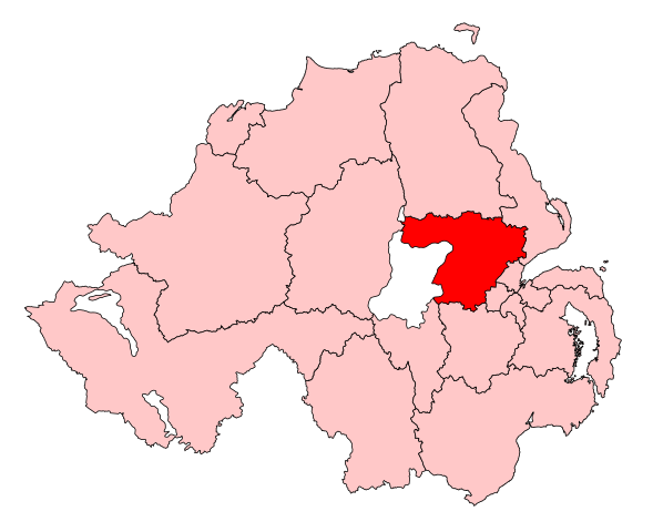
English: Map of the UK Parliament constituency of South Antrim within Northern Ireland. |
| Source | Travail personnel |
| Auteur | Wereon |
Conditions d’utilisation
| Moi, propriétaire des droits d’auteur sur cette œuvre, la place dans le domaine public. Ceci s'applique dans le monde entier. Dans certains pays, ceci peut ne pas être possible ; dans ce cas : J’accorde à toute personne le droit d’utiliser cette œuvre dans n’importe quel but, sans aucune condition, sauf celles requises par la loi. |
Historique du fichier
Cliquer sur une date et heure pour voir le fichier tel qu'il était à ce moment-là.
| Date et heure | Vignette | Dimensions | Utilisateur | Commentaire | |
|---|---|---|---|---|---|
| actuel | 14 mai 2017 à 13:19 | | 779 × 635 (135 kio) | FlyingChrysalis | Current (2008) boundaries with old colours. Derived from File:United Kingdom general election, 2015 (Northern Ireland).svg |
| 13 mai 2017 à 17:53 |  | 280 × 225 (87 kio) | Renamed user OCfxJKu7j2 | Reverted to version as of 14:15, 1 April 2007 (UTC) wrong colour, already 2010 boundarioes | |
| 12 mai 2017 à 19:20 |  | 650 × 520 (150 kio) | FlyingChrysalis | Colours and 2010 boundaries | |
| 1 avril 2007 à 16:15 |  | 280 × 225 (87 kio) | Wereon | Map of the UK Parliament constituency of South Antrim within Northern Ireland. Category:Maps of Parliamentary constituencies in Northern Ireland |
.svg)
Utilisation du fichier
Les 5 pages suivantes utilisent ce fichier :
Usage global du fichier
Les autres wikis suivants utilisent ce fichier :
- Utilisation sur cy.wiki.x.io
- Utilisation sur de.wiki.x.io
- Utilisation sur en.wiki.x.io
- Utilisation sur ga.wiki.x.io
- Utilisation sur it.wiki.x.io
- Utilisation sur simple.wiki.x.io
- Utilisation sur www.wikidata.org
- Utilisation sur zh.wiki.x.io