Fichier:Santa Cruz topographic map-es.png

Taille de cet aperçu : 596 × 600 pixels. Autres résolutions : 239 × 240 pixels | 477 × 480 pixels | 763 × 768 pixels | 1 018 × 1 024 pixels | 2 036 × 2 048 pixels | 3 189 × 3 208 pixels.
Fichier d’origine (3 189 × 3 208 pixels, taille du fichier : 2,12 Mio, type MIME : image/png)
Ce fichier et sa description proviennent de Wikimedia Commons.
| Description |
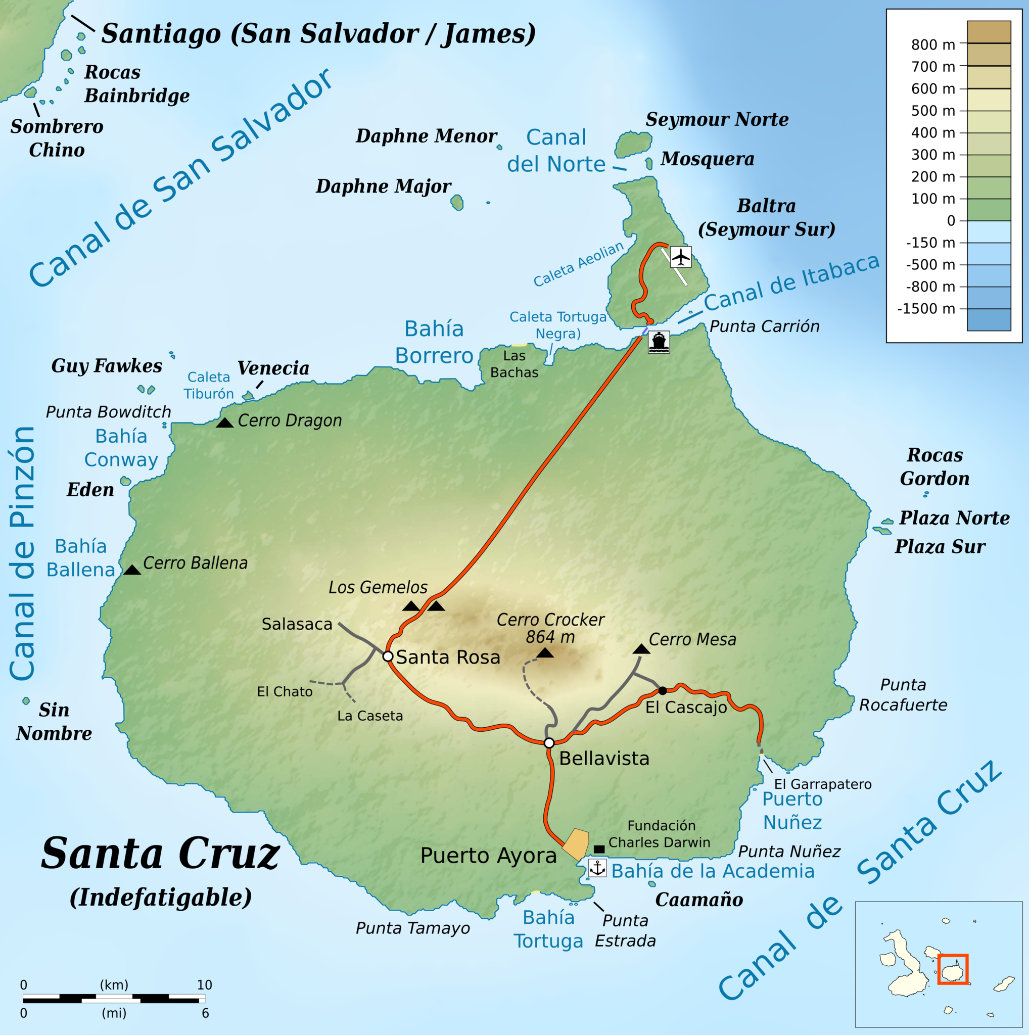
English: Topographic map of en:Santa Cruz Island (Galápagos)
cylindrical equidistant projection, central meridian -90° 30', standard parallel 0° |
|||||||
| Date | ||||||||
| Source |
own work, using: |
|||||||
| Auteur | Bamse | |||||||
| Autorisation (Réutilisation de ce fichier) |
|
|||||||
| Autres versions |
|


Historique du fichier
Cliquer sur une date et heure pour voir le fichier tel qu'il était à ce moment-là.
| Date et heure | Vignette | Dimensions | Utilisateur | Commentaire | |
|---|---|---|---|---|---|
| actuel | 2 juin 2016 à 23:38 | | 3 189 × 3 208 (2,12 Mio) | Bamse | added some more translations |
| 2 juin 2016 à 22:59 |  | 3 189 × 3 208 (2,12 Mio) | Bamse | fix airport icon | |
| 2 juin 2016 à 22:57 |  | 3 189 × 3 208 (2,12 Mio) | Bamse | {{Information |Description ={{en|1=Topographic map of en:Santa Cruz Island (Galápagos)}} cylindrical equidistant projection, central meridian -90° 30', standard parallel 0° |Source =own work, using: * [[:File:Ecuador Galápagos Islan... |
Utilisation du fichier
La page suivante utilise ce fichier :
Usage global du fichier
Les autres wikis suivants utilisent ce fichier :
- Utilisation sur ast.wiki.x.io
- Utilisation sur es.wiki.x.io
- Utilisation sur gl.wiki.x.io
- Utilisation sur id.wiki.x.io
- Utilisation sur it.wiki.x.io
- Utilisation sur ja.wiki.x.io