Fichier:Puntland map regions.png
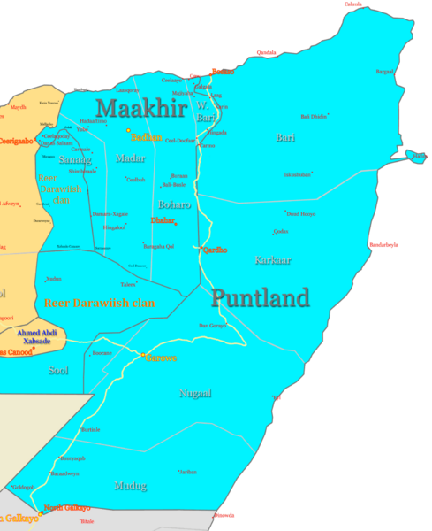
Taille de cet aperçu : 489 × 600 pixels. Autres résolutions : 196 × 240 pixels | 391 × 480 pixels | 823 × 1 009 pixels.
Fichier d’origine (823 × 1 009 pixels, taille du fichier : 157 kio, type MIME : image/png)
Historique du fichier
Cliquer sur une date et heure pour voir le fichier tel qu'il était à ce moment-là.
| Date et heure | Vignette | Dimensions | Utilisateur | Commentaire | |
|---|---|---|---|---|---|
| actuel | 18 mars 2023 à 00:04 |  | 823 × 1 009 (157 kio) | Ayakatalintaguri3 | . |
| 27 février 2008 à 20:05 |  | 823 × 1 009 (57 kio) | Ingoman | ||
| 14 décembre 2007 à 22:15 |  | 992 × 1 087 (72 kio) | Ingoman | ||
| 27 octobre 2007 à 22:40 |  | 1 176 × 1 236 (93 kio) | Ingoman | ||
| 25 octobre 2007 à 03:12 |  | 1 036 × 1 224 (75 kio) | Ingoman | ||
| 22 octobre 2007 à 08:40 |  | 1 128 × 1 348 (85 kio) | Ingoman | ||
| 2 octobre 2007 à 04:25 |  | 1 216 × 1 327 (90 kio) | Ingoman | {{Information |Description=Map of Puntland State of Somalia |Source=self-made |Date=October 1st 2007 |Author= Ingoman }} |
Utilisation du fichier
La page suivante utilise ce fichier :
Usage global du fichier
Les autres wikis suivants utilisent ce fichier :
- Utilisation sur azb.wiki.x.io
- Utilisation sur ca.wiki.x.io
- Utilisation sur cs.wiki.x.io
- Utilisation sur eu.wiki.x.io
- Utilisation sur fa.wiki.x.io
- Utilisation sur gl.wiki.x.io
- Utilisation sur he.wiki.x.io
- Utilisation sur id.wiki.x.io
- Utilisation sur it.wiki.x.io
- Utilisation sur pt.wiki.x.io
- Utilisation sur ru.wiki.x.io
- Utilisation sur war.wiki.x.io
- Utilisation sur www.wikidata.org