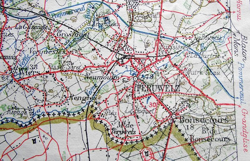
Fichier:Péruwelz tram.jpg

Taille de cet aperçu : 800 × 516 pixels. Autres résolutions : 320 × 207 pixels | 640 × 413 pixels | 1 024 × 661 pixels | 1 280 × 826 pixels | 2 560 × 1 652 pixels | 3 483 × 2 248 pixels.
Fichier d’origine (3 483 × 2 248 pixels, taille du fichier : 943 kio, type MIME : image/jpeg)
Historique du fichier
Cliquer sur une date et heure pour voir le fichier tel qu'il était à ce moment-là.
| Date et heure | Vignette | Dimensions | Utilisateur | Commentaire | |
|---|---|---|---|---|---|
| actuel | 19 décembre 2010 à 11:30 |  | 3 483 × 2 248 (943 kio) | Smiley.toerist | {{Information |Description={{en|1=Railways and tramlines around Péruwelz in 1922. The vicinal railway terminates to the south of the railway station. From there there is the horsedrawn tramway to the border at Bonsecour. At the French border there anoth |
Utilisation du fichier
La page suivante utilise ce fichier :
Usage global du fichier
Les autres wikis suivants utilisent ce fichier :
- Utilisation sur nl.wiki.x.io