Fichier:North Luconia Shoals f 12.jpg

Fichier d’origine (1 200 × 1 346 pixels, taille du fichier : 250 kio, type MIME : image/jpeg)

Ce fichier et sa description proviennent de Wikimedia Commons.

Description

Description
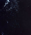
Deutsch: Landsat 7 Satellitenbild der nördlichen Luconia-Untiefen (auch -Riffe, englisch North Luconia Shoals) im Südchinesische Meer südwestlich der Spratly-Inseln auf dem Festlandsockel vor dem malaysischen Bundesstaat Sarawak.
Die Belichtung des Bilds wurde um ca. 12 Blendenstufen angehoben. Die Originalfarbe (RGB: 52,29,61) spielt ins Violette, daher wurde eine Farbüberlagerung (RGB:6,36,47) verwendet auf Basis der Farbe des Satelliten-Bilds von Bing Maps für diese Koordinaten 5°36′0.0″N 112°36′0.0″W / 5.6°N 112.6°W / 5.6; -112.6.
English: Landsat 7 satellite image of the North Luconia Shoals in the South China Sea southwest of the Spratly Islands on the continental shelf in front of the Malaysian state of Sarawak.
The exposure of the image has been increased by about 12 f-stops. The original color (RGB: 52,29,61) is purplish, therefore a color overlay was used which is based on the color (RGB:6,36,47) of the Satellite Image of Bing Maps for this coordinates 5°36′0.0″N 112°36′0.0″W / 5.6°N 112.6°W / 5.6; -112.6.
Date
Source https://web.archive.org/web/20120724041608/http://www.oceandots.com/pacific/luconia/
Auteur NASA
Autres versions

Conditions d’utilisation

Public domain Ce fichier provient de la NASA. Sauf exception, les documents créés par la NASA ne sont pas soumis à copyright. Pour plus d'informations, voir la politique de copyright de la NASA.
Attention :
Annotations
InfoField
Cette image est annotée : Voir les annotations sur Wikimedia Commons

Légendes

Ajoutez en une ligne la description de ce que représente ce fichier

Éléments décrits dans ce fichier

dépeint

Historique du fichier

Cliquer sur une date et heure pour voir le fichier tel qu'il était à ce moment-là.

Date et heureVignetteDimensionsUtilisateurCommentaire
actuel19 mai 2015 à 11:46Vignette pour la version du 19 mai 2015 à 11:461 200 × 1 346 (250 kio)MagentaGreenWolkendecke gelüftet - cloud cover lifted - couche nuageuse soulevée
18 mai 2015 à 18:06Vignette pour la version du 18 mai 2015 à 18:061 200 × 1 346 (357 kio)MagentaGreen=={{int:filedesc}}== {{Information |description={{de|1=Landsat 7 Satellitenbild der nördlichen Luconia-Untiefen (auch -Riffe, englisch North Luconia Shoals) im Südchinesische Meer südwestlich der Spratly-Inseln auf dem Festlandsockel vor dem malaysi...

La page suivante utilise ce fichier :

Usage global du fichier

Les autres wikis suivants utilisent ce fichier :

Métadonnées