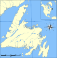
Fichier:Newfoundland map blank.png

Taille de cet aperçu : 590 × 599 pixels. Autres résolutions : 236 × 240 pixels | 472 × 480 pixels | 1 000 × 1 016 pixels.
Fichier d’origine (1 000 × 1 016 pixels, taille du fichier : 344 kio, type MIME : image/png)
Historique du fichier
Cliquer sur une date et heure pour voir le fichier tel qu'il était à ce moment-là.
| Date et heure | Vignette | Dimensions | Utilisateur | Commentaire | |
|---|---|---|---|---|---|
| actuel | 8 novembre 2015 à 23:31 |  | 1 000 × 1 016 (344 kio) | Flappiefh | Added Saint-Pierre and Miquelon. |
| 11 janvier 2013 à 22:39 |  | 1 000 × 1 016 (108 kio) | Flappiefh | Replaced "kilometres" with "km" and "NORTH" by a compass. This way the file can be used in many languages. | |
| 5 juin 2007 à 12:37 |  | 1 000 × 1 016 (114 kio) | Coach.nyta | {{Information |Description=A map of Newfoundland with no markings |Source=Image:Gander_Lake_map.png |Date=June 5, 2007 |Author= User:Coach.nyta }} Category:Maps of Newfoundland Category:Maps of Newfoundland and Labrador |
Utilisation du fichier
Les 3 pages suivantes utilisent ce fichier :
Usage global du fichier
Les autres wikis suivants utilisent ce fichier :
- Utilisation sur br.wiki.x.io
- Utilisation sur et.wiki.x.io
- Utilisation sur gv.wiki.x.io
- Utilisation sur sl.wiki.x.io
