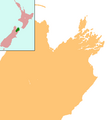
Fichier:NZ-Marlborough plain map.png
NZ-Marlborough_plain_map.png (378 × 423 pixels, taille du fichier : 10 kio, type MIME : image/png)
Historique du fichier
Cliquer sur une date et heure pour voir le fichier tel qu'il était à ce moment-là.
| Date et heure | Vignette | Dimensions | Utilisateur | Commentaire | |
|---|---|---|---|---|---|
| actuel | 18 mai 2008 à 01:09 |  | 378 × 423 (10 kio) | Grutness | |Source= |Date= |Author= |Permission= |other_versions= }} {{Information |Description=Locator map for Marlborough, New Zealand |Source=combination of Image:NZ-SI plain map.png and Image:Marlborough nz location.png |Date=18 May 2008 |Author=Grutn |
Utilisation du fichier
La page suivante utilise ce fichier :
Usage global du fichier
Les autres wikis suivants utilisent ce fichier :
- Utilisation sur ar.wiki.x.io
- Utilisation sur ceb.wiki.x.io
- Utilisation sur en.wiki.x.io
- Clarence, New Zealand
- Lake Grassmere
- Woodbourne Airport
- Wharanui
- Moenui
- Nelson Airport (New Zealand)
- List of schools in the Marlborough District
- Tennyson Inlet
- Module:Location map/data/New Zealand Marlborough/doc
- Canvastown
- Waitaria Bay
- Koromiko, New Zealand
- Pelorus Bridge
- Bulwer, New Zealand
- Omaka Aerodrome
- Module:Location map/data/New Zealand Marlborough
- Ward Beach
- Matapara / Pickersgill Island
- Utilisation sur fa.wiki.x.io
- Utilisation sur kn.wiki.x.io
- Utilisation sur ko.wiki.x.io
- Utilisation sur mi.wiki.x.io
- Utilisation sur mk.wiki.x.io
- Utilisation sur ms.wiki.x.io
- Utilisation sur si.wiki.x.io
- Utilisation sur tr.wiki.x.io
- Utilisation sur ur.wiki.x.io
- Utilisation sur uz.wiki.x.io
- Utilisation sur war.wiki.x.io
- Utilisation sur zh.wiki.x.io
