Fichier:Monmouthshire Brit Isles Sect 5.svg

Taille de cet aperçu PNG pour ce fichier SVG : 653 × 600 pixels. Autres résolutions : 261 × 240 pixels | 523 × 480 pixels | 836 × 768 pixels | 1 115 × 1 024 pixels | 2 230 × 2 048 pixels | 809 × 743 pixels.
Fichier d’origine (Fichier SVG, nominalement de 809 × 743 pixels, taille : 939 kio)
Ce fichier et sa description proviennent de Wikimedia Commons.
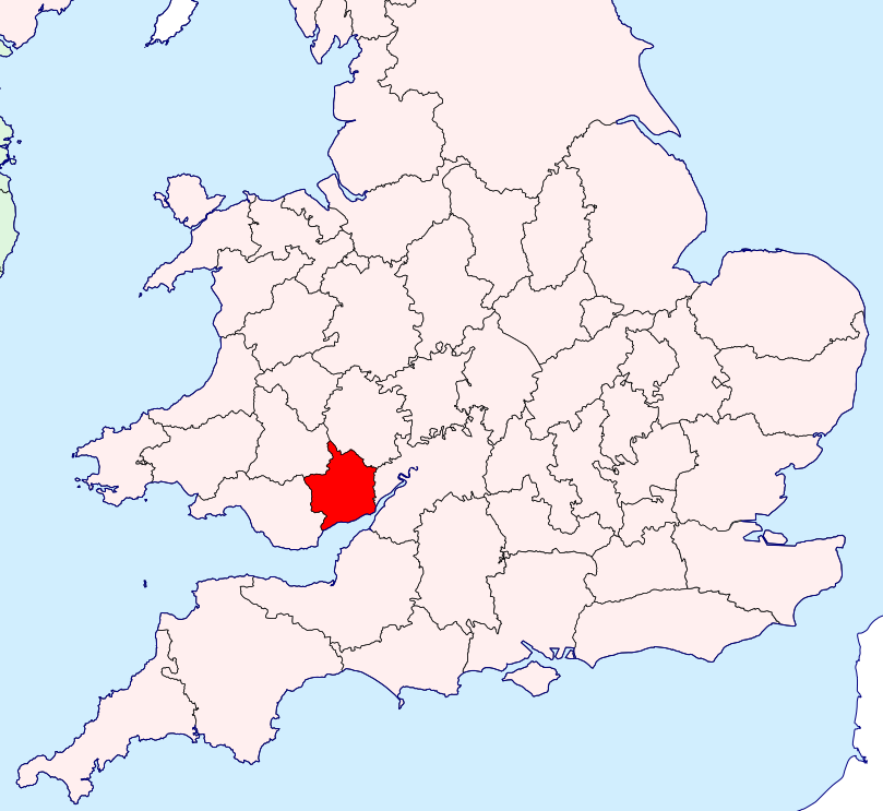
| Description | Monmouthshire location map | ||
| Date | |||
| Source | British Isles in counties.svg | ||
| Auteur | User:Visitor from Wikishire | ||
| Autorisation (Réutilisation de ce fichier) |
|
Historique du fichier
Cliquer sur une date et heure pour voir le fichier tel qu'il était à ce moment-là.
| Date et heure | Vignette | Dimensions | Utilisateur | Commentaire | |
|---|---|---|---|---|---|
| actuel | 14 septembre 2019 à 10:12 | | 809 × 743 (939 kio) | Hogweard | Colours |
| 14 septembre 2019 à 10:09 |  | 809 × 743 (939 kio) | Hogweard | Colours | |
| 13 janvier 2015 à 01:20 |  | 809 × 743 (934 kio) | Visitor from Wikishire | {{Information |Description=Monmouthshire location map |Source=British Isles in counties.svg |Date=2014-01-11 |Author=User:Visitor from Wikishire |Permission={{PD-self}} |other_versions= }} [[Category:Maps of... |
Utilisation du fichier
La page suivante utilise ce fichier :
Usage global du fichier
Les autres wikis suivants utilisent ce fichier :
- Utilisation sur ang.wiki.x.io
- Utilisation sur en.wiki.x.io
- Utilisation sur la.wiki.x.io
- Utilisation sur simple.wiki.x.io
- Utilisation sur www.wikidata.org
- Utilisation sur zh.wiki.x.io