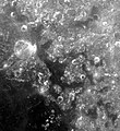
Fichier:Mare Anguis.jpg
Mare_Anguis.jpg (350 × 382 pixels, taille du fichier : 19 kio, type MIME : image/jpeg)
Historique du fichier
Cliquer sur une date et heure pour voir le fichier tel qu'il était à ce moment-là.
| Date et heure | Vignette | Dimensions | Utilisateur | Commentaire | |
|---|---|---|---|---|---|
| actuel | 1 juin 2007 à 01:49 |  | 350 × 382 (19 kio) | Bryan Derksen | {{Information |Description={{en|en:Mare Anguis is seen in the middle of the picture below. It is located on the near side of the moon (the side facing the Earth), and is about 150 miles in diameter. Located within the Crisium basin, Mare Anguis is a |
Utilisation du fichier
La page suivante utilise ce fichier :
Usage global du fichier
Les autres wikis suivants utilisent ce fichier :
- Utilisation sur ar.wiki.x.io
- Utilisation sur be.wiki.x.io
- Utilisation sur ca.wiki.x.io
- Utilisation sur cs.wiki.x.io
- Utilisation sur da.wiki.x.io
- Utilisation sur de.wiki.x.io
- Utilisation sur en.wiki.x.io
- Utilisation sur es.wiki.x.io
- Utilisation sur fa.wiki.x.io
- Utilisation sur he.wiki.x.io
- Utilisation sur id.wiki.x.io
- Utilisation sur it.wiki.x.io
- Utilisation sur ko.wiki.x.io
- Utilisation sur la.wiki.x.io
- Utilisation sur lb.wiki.x.io
- Utilisation sur lv.wiki.x.io
- Utilisation sur nl.wiki.x.io
- Utilisation sur pl.wiki.x.io
- Utilisation sur pt.wiki.x.io
- Utilisation sur ru.wiki.x.io
- Utilisation sur uk.wiki.x.io
- Utilisation sur zh.wiki.x.io


