Fichier:Map of Southern Ostrobothnia-fi.svg

Taille de cet aperçu PNG pour ce fichier SVG : 678 × 599 pixels. Autres résolutions : 272 × 240 pixels | 543 × 480 pixels | 869 × 768 pixels | 1 159 × 1 024 pixels | 2 317 × 2 048 pixels | 1 042 × 921 pixels.
Fichier d’origine (Fichier SVG, nominalement de 1 042 × 921 pixels, taille : 69 kio)
Ce fichier et sa description proviennent de Wikimedia Commons.
Description
| Description |
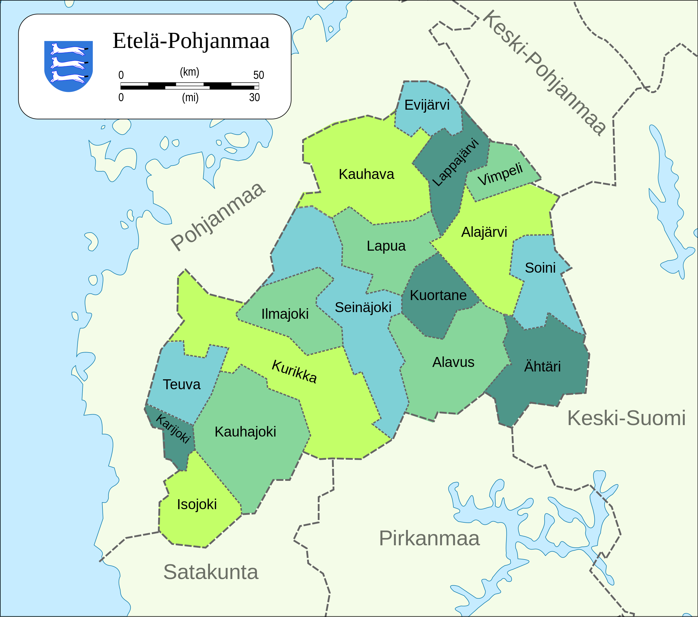
English: Map of the municipalities of the Southern Ostrobothnia region of Finland.
Suomi: Kartta Etelä-Pohjanmaan maakunnan kunnista. |
| Date |
|
| Source |
|
| Auteur |
Conditions d’utilisation
| Moi, propriétaire des droits d’auteur sur cette œuvre, la place dans le domaine public. Ceci s'applique dans le monde entier. Dans certains pays, ceci peut ne pas être possible ; dans ce cas : J’accorde à toute personne le droit d’utiliser cette œuvre dans n’importe quel but, sans aucune condition, sauf celles requises par la loi. |
Historique du fichier
Cliquer sur une date et heure pour voir le fichier tel qu'il était à ce moment-là.
| Date et heure | Vignette | Dimensions | Utilisateur | Commentaire | |
|---|---|---|---|---|---|
| actuel | 3 mars 2019 à 13:59 | | 1 042 × 921 (69 kio) | Fenn-O-maniC | Updated Kurikka |
| 17 août 2013 à 21:44 |  | 1 303 × 1 151 (413 kio) | Stryn | new version (2013) | |
| 17 juillet 2010 à 04:41 |  | 1 042 × 921 (72 kio) | Mysid | {{Information |Description={{en|1=Map of the municipalities of the Southern Ostrobothnia region of Finland.}} {{fi|1=Kartta Etelä-Pohjanmaan maakunnan kunnista.}} |Source=Self-made in Inkscape. Municipality borders from File:Suomi.kunnat.2010.svg wi |
Utilisation du fichier
La page suivante utilise ce fichier :
Usage global du fichier
Les autres wikis suivants utilisent ce fichier :
- Utilisation sur ceb.wiki.x.io
- Utilisation sur en.wiki.x.io
- Utilisation sur et.wiki.x.io
- Utilisation sur fi.wiki.x.io
- Utilisation sur gl.wiki.x.io
- Utilisation sur nl.wiki.x.io
- Utilisation sur ru.wiki.x.io
- Utilisation sur sv.wiki.x.io
- Utilisation sur uk.wiki.x.io
- Utilisation sur zh-min-nan.wiki.x.io