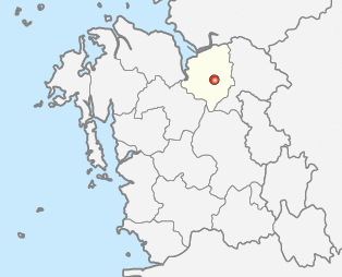
Fichier:Map Asan-si.png
Map_Asan-si.png (314 × 254 pixels, taille du fichier : 31 kio, type MIME : image/png)
Historique du fichier
Cliquer sur une date et heure pour voir le fichier tel qu'il était à ce moment-là.
| Date et heure | Vignette | Dimensions | Utilisateur | Commentaire | |
|---|---|---|---|---|---|
| actuel | 2 juin 2012 à 18:15 |  | 314 × 254 (31 kio) | Geoarchive | Update establishment of Sejong Special Autonomous City, Relocate location of Asan-Si office, Change into more accurate lines of administrative district |
| 25 juin 2011 à 02:01 |  | 300 × 258 (6 kio) | Asfreeas | color and form match | |
| 23 décembre 2004 à 18:18 |  | 301 × 258 (5 kio) | Visviva | {{GFDL}}Made from Maps of Korea. |
Utilisation du fichier
La page suivante utilise ce fichier :
Usage global du fichier
Les autres wikis suivants utilisent ce fichier :
- Utilisation sur en.wiki.x.io
- Utilisation sur fa.wiki.x.io
- Utilisation sur fi.wiki.x.io
- Utilisation sur it.wiki.x.io
- Utilisation sur ja.wiki.x.io
- Utilisation sur ko.wiki.x.io
- Utilisation sur no.wiki.x.io
- Utilisation sur sv.wiki.x.io
- Utilisation sur vi.wiki.x.io
- Utilisation sur zh-yue.wiki.x.io

