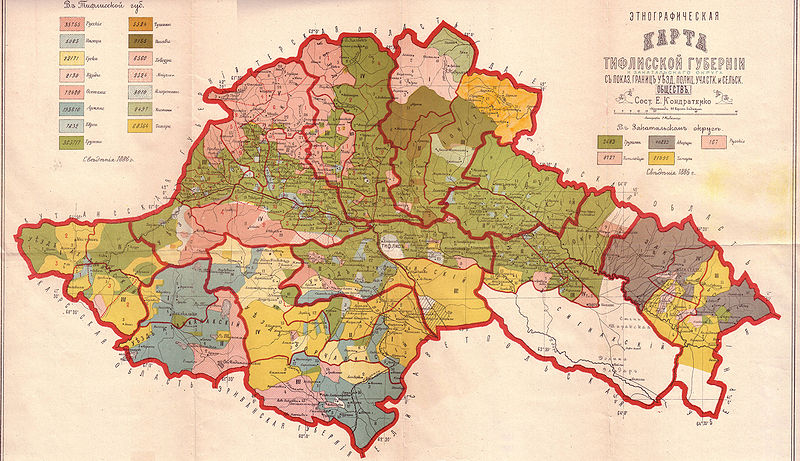
Fichier:Map-etno-tiflis.jpg

Taille de cet aperçu : 800 × 461 pixels. Autres résolutions : 320 × 184 pixels | 640 × 369 pixels | 1 024 × 590 pixels | 1 280 × 738 pixels | 2 560 × 1 475 pixels | 5 900 × 3 400 pixels.
Fichier d’origine (5 900 × 3 400 pixels, taille du fichier : 3,77 Mio, type MIME : image/jpeg)
Historique du fichier
Cliquer sur une date et heure pour voir le fichier tel qu'il était à ce moment-là.
| Date et heure | Vignette | Dimensions | Utilisateur | Commentaire | |
|---|---|---|---|---|---|
| actuel | 28 février 2010 à 13:43 |  | 5 900 × 3 400 (3,77 Mio) | Kober | {{Information |Description={{en|1=Ethnographic map of the Tiflis Governorate}} |Source=[http://ikalto.com/index-maps.php Ikalto.com] from Кавказскій календарь, Тифлисъ, 1902 |Author=E. Kondratenko |Date=1902 |Permission= |other_v |
Utilisation du fichier
La page suivante utilise ce fichier :
Usage global du fichier
Les autres wikis suivants utilisent ce fichier :
- Utilisation sur az.wiki.x.io
- Utilisation sur de.wiki.x.io
- Utilisation sur es.wiki.x.io
- Utilisation sur hy.wiki.x.io
- Utilisation sur id.wiki.x.io
- Utilisation sur ka.wiki.x.io
- Utilisation sur nl.wiki.x.io
- Zuid-Ossetië
- Gouvernement Tiflis
- Gori (gemeente)
- Kaspi (gemeente)
- Kareli (gemeente)
- Chasjoeri (gemeente)
- Achalgori (gemeente)
- Achmeta (gemeente)
- Dmanisi (gemeente)
- Doesjeti (gemeente)
- Mtscheta (gemeente)
- Kazbegi (gemeente)
- Kvareli (gemeente)
- Sagaredzjo (gemeente)
- Telavi (gemeente)
- Tianeti (gemeente)
- Tsalka (gemeente)
- Troesovallei
- Gebruiker:Lidewij C J./ Zoeken
- Utilisation sur ru.wiki.x.io
- Utilisation sur uk.wiki.x.io
- Utilisation sur xmf.wiki.x.io


