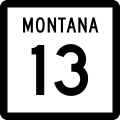
Fichier:MT-13.svg

Taille de cet aperçu PNG pour ce fichier SVG : 600 × 600 pixels. Autres résolutions : 240 × 240 pixels | 480 × 480 pixels | 768 × 768 pixels | 1 024 × 1 024 pixels | 2 048 × 2 048 pixels.
Fichier d’origine (Fichier SVG, nominalement de 600 × 600 pixels, taille : 8 kio)
Historique du fichier
Cliquer sur une date et heure pour voir le fichier tel qu'il était à ce moment-là.
| Date et heure | Vignette | Dimensions | Utilisateur | Commentaire | |
|---|---|---|---|---|---|
| actuel | 20 janvier 2012 à 08:27 |  | 600 × 600 (8 kio) | Fredddie | |
| 7 janvier 2007 à 23:31 |  | 600 × 600 (7 kio) | Master son | {{Information| |Description=Montana secondary state highway marker. Uses the FHWA font (type C font) |Source=http://www.mdt.mt.gov/other/contract/external/detailed_drawings/2005/english/section_619.pdf |Date=2007.1.7 |Author=User:Master_son |Permissio |
Utilisation du fichier
La page suivante utilise ce fichier :
Usage global du fichier
Les autres wikis suivants utilisent ce fichier :
- Utilisation sur de.wiki.x.io
- Utilisation sur el.wiki.x.io
- Utilisation sur en.wiki.x.io
- Roosevelt County, Montana
- McCone County, Montana
- Daniels County, Montana
- List of state highways in Montana
- Montana Highway 16
- List of crossings of the Missouri River
- List of highways numbered 13
- List of Canada–United States border crossings
- Saskatchewan Highway 36
- Montana Highway 200
- Montana Highway 25
- U.S. Route 2 in Montana
- U.S. Route 12 in Montana
- Montana Highway 5
- Montana Highway 13
- Interstate 15 in Montana
- User:DyluckTRocket/Highway Edit Log
- Scobey–Coronach Border Crossing
- List of bridges documented by the Historic American Engineering Record in Montana
- User:40bus/US-Canada highways combined
- Utilisation sur es.wiki.x.io
- Utilisation sur it.wiki.x.io
- Utilisation sur ja.wiki.x.io
- Utilisation sur www.wikidata.org
- Utilisation sur zh-min-nan.wiki.x.io
