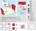
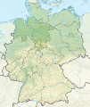
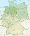
Fichier:Locator map HGW 2011 in Germany.svg

Taille de cet aperçu PNG pour ce fichier SVG : 506 × 600 pixels. Autres résolutions : 202 × 240 pixels | 405 × 480 pixels | 648 × 768 pixels | 864 × 1 024 pixels | 1 728 × 2 048 pixels | 1 073 × 1 272 pixels.
Fichier d’origine (Fichier SVG, nominalement de 1 073 × 1 272 pixels, taille : 886 kio)
Historique du fichier
Cliquer sur une date et heure pour voir le fichier tel qu'il était à ce moment-là.
| Date et heure | Vignette | Dimensions | Utilisateur | Commentaire | |
|---|---|---|---|---|---|
| actuel | 15 décembre 2010 à 13:29 |  | 1 073 × 1 272 (886 kio) | TUBS | =={{int:filedesc}}== {{Information |Description= {{de|Lage von Landkreis Südvorpommern in Mecklenburg-Vorpommern, Deutschland nach der Kreisgebietsreform 2011.}} {{en|Locator map of Landkreis Südvorpomm |
Utilisation du fichier
La page suivante utilise ce fichier :
Usage global du fichier
Les autres wikis suivants utilisent ce fichier :
- Utilisation sur cs.wiki.x.io
- Utilisation sur da.wiki.x.io
- Utilisation sur de.wiki.x.io
- Utilisation sur eo.wiki.x.io
- Utilisation sur fi.wiki.x.io
- Utilisation sur frr.wiki.x.io
- Utilisation sur fy.wiki.x.io
- Utilisation sur hu.wiki.x.io
- Utilisation sur it.wiki.x.io
- Utilisation sur ja.wiki.x.io
- Utilisation sur lv.wiki.x.io
- Utilisation sur nl.wiki.x.io
- Utilisation sur pl.wiki.x.io
- Utilisation sur pnb.wiki.x.io
- Utilisation sur sv.wiki.x.io
- Utilisation sur uk.wiki.x.io


