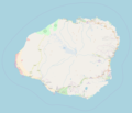
Fichier:Location Map Kauai.png

Taille de cet aperçu : 697 × 599 pixels. Autres résolutions : 279 × 240 pixels | 558 × 480 pixels | 893 × 768 pixels | 1 191 × 1 024 pixels | 1 904 × 1 637 pixels.
Fichier d’origine (1 904 × 1 637 pixels, taille du fichier : 467 kio, type MIME : image/png)
Historique du fichier
Cliquer sur une date et heure pour voir le fichier tel qu'il était à ce moment-là.
| Date et heure | Vignette | Dimensions | Utilisateur | Commentaire | |
|---|---|---|---|---|---|
| actuel | 25 octobre 2017 à 18:31 |  | 1 904 × 1 637 (467 kio) | Mliu92 | Updated with closer view of island. |
| 25 octobre 2017 à 16:23 |  | 2 051 × 1 895 (454 kio) | Mliu92 | User created page with UploadWizard |
Utilisation du fichier
La page suivante utilise ce fichier :
Usage global du fichier
Les autres wikis suivants utilisent ce fichier :
- Utilisation sur en.wiki.x.io
- Waimea Canyon State Park
- Nā Pali Coast State Park
- Kōkeʻe State Park
- Russian Fort Elizabeth
- Haʻena State Park
- Polihale State Park
- Wailua River State Park
- Honopū Valley
- Waiʻoli Mission District
- Grove Farm (Lihue, Hawaii)
- Puʻuʻōpae Bridge
- Module:Location map/data/United States Kauai
- Module:Location map/data/United States Kauai/doc
- Kōʻula River
- Hanapēpē River
- Princeville Botanical Gardens
- Utilisation sur ml.wiki.x.io
- Utilisation sur si.wiki.x.io
- Utilisation sur uz.wiki.x.io
- Utilisation sur zh.wiki.x.io