Fichier:Lloyds-harbor-map.gif
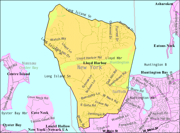
Lloyds-harbor-map.gif (575 × 425 pixels, taille du fichier : 45 kio, type MIME : image/gif)
Historique du fichier
Cliquer sur une date et heure pour voir le fichier tel qu'il était à ce moment-là.
| Date et heure | Vignette | Dimensions | Utilisateur | Commentaire | |
|---|---|---|---|---|---|
| actuel | 23 août 2013 à 07:06 |  | 575 × 425 (45 kio) | Dcirovic | {{Information |Description={{en|en:U.S. Census 2000 reference map for en:Lloyd Harbor, New York<br/> It's Lloyd Harbor, NOT Lloyd's}} |Source=Transferred from [http://en.wiki.x.io en.wikipedia]<br/> (Original text : ''http://factfinder... |
Utilisation du fichier
La page suivante utilise ce fichier :
Usage global du fichier
Les autres wikis suivants utilisent ce fichier :
- Utilisation sur ar.wiki.x.io
- Utilisation sur ca.wiki.x.io
- Utilisation sur cy.wiki.x.io
- Utilisation sur en.wiki.x.io
- Utilisation sur es.wiki.x.io
- Utilisation sur eu.wiki.x.io
- Utilisation sur glk.wiki.x.io
- Utilisation sur ht.wiki.x.io
- Utilisation sur sh.wiki.x.io
- Utilisation sur sr.wiki.x.io
- Utilisation sur www.wikidata.org

