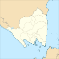
Fichier:Indonesia Lampung location map.svg

Taille de cet aperçu PNG pour ce fichier SVG : 600 × 600 pixels. Autres résolutions : 240 × 240 pixels | 480 × 480 pixels | 768 × 768 pixels | 1 024 × 1 024 pixels | 2 048 × 2 048 pixels | 1 250 × 1 250 pixels.
Fichier d’origine (Fichier SVG, nominalement de 1 250 × 1 250 pixels, taille : 2,69 Mio)
Historique du fichier
Cliquer sur une date et heure pour voir le fichier tel qu'il était à ce moment-là.
| Date et heure | Vignette | Dimensions | Utilisateur | Commentaire | |
|---|---|---|---|---|---|
| actuel | 21 décembre 2017 à 08:59 |  | 1 250 × 1 250 (2,69 Mio) | Mandamaruta | User created page with UploadWizard |
Utilisation du fichier
Les 3 pages suivantes utilisent ce fichier :
Usage global du fichier
Les autres wikis suivants utilisent ce fichier :
- Utilisation sur ban.wiki.x.io
- Utilisation sur he.wiki.x.io
- Utilisation sur id.wiki.x.io
- Kota Metro
- Daftar kabupaten dan kota di Lampung
- Banjar Agung, Tulang Bawang
- Templat:Location map
- Taman Nasional Bukit Barisan Selatan
- Padang Cermin, Pesawaran
- Pulau Batu Kecil
- Gempa bumi Liwa 1994
- Keuskupan Tanjungkarang
- Daftar paroki di Indonesia
- Kabupaten Pesisir Barat
- Templat:Location map/doc
- Daftar paroki di Keuskupan Tanjungkarang
- Daftar kecamatan dan kelurahan di Lampung
- Modul:Location map/data/Indonesia Lampung
- Pulau Sebuku (Sumatra)
- Penyakit Jembrana
- Modul:Location map/data/Indonesia Lampung/doc
- Daftar kabupaten dan kota di Lampung berdasarkan waktu pembentukan
- Utilisation sur incubator.wikimedia.org
- Utilisation sur it.wiki.x.io
- Utilisation sur jv.wiki.x.io
- Utilisation sur www.wikidata.org