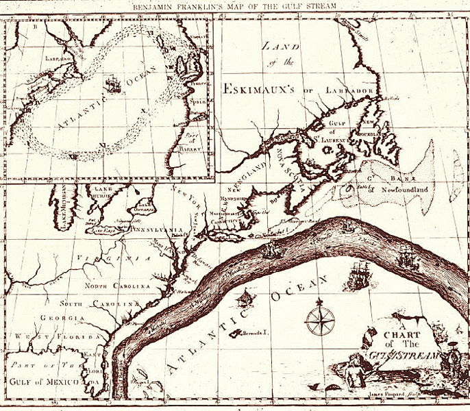
Fichier:Gulf stream map.gif

Taille de cet aperçu : 686 × 600 pixels. Autres résolutions : 275 × 240 pixels | 549 × 480 pixels | 700 × 612 pixels.
Fichier d’origine (700 × 612 pixels, taille du fichier : 222 kio, type MIME : image/gif)
Historique du fichier
Cliquer sur une date et heure pour voir le fichier tel qu'il était à ce moment-là.
| Date et heure | Vignette | Dimensions | Utilisateur | Commentaire | |
|---|---|---|---|---|---|
| actuel | 5 juin 2010 à 07:23 |  | 700 × 612 (222 kio) | File Upload Bot (Magnus Manske) | {{BotMoveToCommons|en.wikipedia|year={{subst:CURRENTYEAR}}|month={{subst:CURRENTMONTHNAME}}|day={{subst:CURRENTDAY}}}} {{Information |Description={{en|Map of the Gulf Stream by Benjamin Franklin. Courtesy of NOAA Photo Library.}} |Source=Transferred from |
Utilisation du fichier
La page suivante utilise ce fichier :
Usage global du fichier
Les autres wikis suivants utilisent ce fichier :
- Utilisation sur da.wiki.x.io
- Utilisation sur da.wikibooks.org
- Utilisation sur en.wiki.x.io
- Utilisation sur hy.wiki.x.io
- Utilisation sur id.wiki.x.io
- Utilisation sur kn.wiki.x.io
- Utilisation sur ko.wiki.x.io
- Utilisation sur la.wiki.x.io
- Utilisation sur mk.wiki.x.io
- Utilisation sur oc.wiki.x.io
- Utilisation sur sd.wiki.x.io
- Utilisation sur si.wiki.x.io
- Utilisation sur ta.wiki.x.io
- Utilisation sur tl.wiki.x.io
