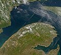
Fichier:GaspePeninsula23.jpg
GaspePeninsula23.jpg (300 × 271 pixels, taille du fichier : 15 kio, type MIME : image/jpeg)
Historique du fichier
Cliquer sur une date et heure pour voir le fichier tel qu'il était à ce moment-là.
| Date et heure | Vignette | Dimensions | Utilisateur | Commentaire | |
|---|---|---|---|---|---|
| actuel | 12 mai 2005 à 11:01 |  | 300 × 271 (15 kio) | Big iron | Description: Satellite image of Gaspe peninsula From: SeaWiFS Level 1A image of the Canadian Maritime provinces and northeastern United States, acquired May 18, 2003. Source: NASA Goddard Earth Sciences Data and Information Services Center {{PD-USGov-N |
Utilisation du fichier
Les 3 pages suivantes utilisent ce fichier :
Usage global du fichier
Les autres wikis suivants utilisent ce fichier :
- Utilisation sur az.wiki.x.io
- Utilisation sur br.wiki.x.io
- Utilisation sur ca.wiki.x.io
- Utilisation sur ceb.wiki.x.io
- Utilisation sur da.wiki.x.io
- Utilisation sur de.wiki.x.io
- Utilisation sur en.wiki.x.io
- Utilisation sur eo.wiki.x.io
- Utilisation sur es.wiki.x.io
- Utilisation sur et.wiki.x.io
- Utilisation sur fa.wiki.x.io
- Utilisation sur fi.wiki.x.io
- Utilisation sur fr.wikivoyage.org
- Utilisation sur id.wiki.x.io
- Utilisation sur incubator.wikimedia.org
- Utilisation sur it.wiki.x.io
- Utilisation sur ja.wiki.x.io
- Utilisation sur ko.wiki.x.io
- Utilisation sur nl.wiki.x.io
- Utilisation sur no.wiki.x.io
- Utilisation sur pl.wiki.x.io
- Utilisation sur pt.wiki.x.io
- Utilisation sur ru.wiki.x.io
- Utilisation sur sv.wiki.x.io
- Utilisation sur uk.wiki.x.io
- Utilisation sur www.wikidata.org
- Utilisation sur zh.wiki.x.io
