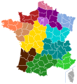
Fichier:France proposal regions (2014) map3.svg

Taille de cet aperçu PNG pour ce fichier SVG : 507 × 553 pixels. Autres résolutions : 220 × 240 pixels | 440 × 480 pixels | 704 × 768 pixels | 939 × 1 024 pixels | 1 878 × 2 048 pixels.
Fichier d’origine (Fichier SVG, nominalement de 507 × 553 pixels, taille : 150 kio)
Historique du fichier
Cliquer sur une date et heure pour voir le fichier tel qu'il était à ce moment-là.
| Date et heure | Vignette | Dimensions | Utilisateur | Commentaire | |
|---|---|---|---|---|---|
| actuel | 3 juin 2014 à 19:21 |  | 507 × 553 (150 kio) | Gtaf | modification de couleurs |
| 3 juin 2014 à 00:22 |  | 507 × 553 (149 kio) | Gtaf | User created page with UploadWizard |
Utilisation du fichier
Les 2 pages suivantes utilisent ce fichier :
Usage global du fichier
Les autres wikis suivants utilisent ce fichier :
- Utilisation sur ar.wiki.x.io
- Utilisation sur arz.wiki.x.io
- Utilisation sur ca.wiki.x.io
- Utilisation sur en.wiki.x.io
- Utilisation sur eu.wiki.x.io
- Utilisation sur nn.wiki.x.io
- Utilisation sur no.wiki.x.io
- Utilisation sur vi.wiki.x.io
