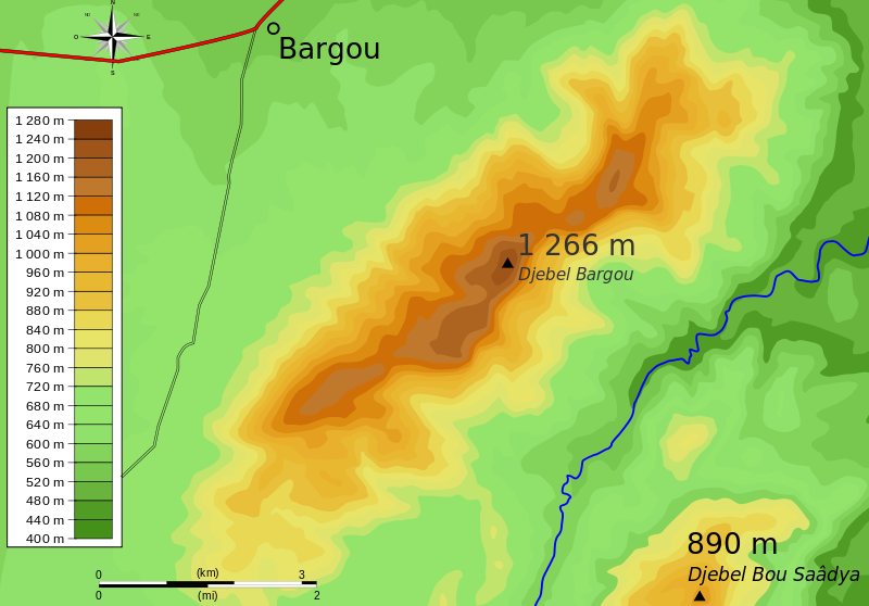
Fichier:Djebel Bargou topography.svg

Taille de cet aperçu PNG pour ce fichier SVG : 800 × 558 pixels. Autres résolutions : 320 × 223 pixels | 640 × 447 pixels | 1 024 × 715 pixels | 1 280 × 894 pixels | 2 560 × 1 787 pixels | 848 × 592 pixels.
Fichier d’origine (Fichier SVG, nominalement de 848 × 592 pixels, taille : 234 kio)
Historique du fichier
Cliquer sur une date et heure pour voir le fichier tel qu'il était à ce moment-là.
| Date et heure | Vignette | Dimensions | Utilisateur | Commentaire | |
|---|---|---|---|---|---|
| actuel | 19 juillet 2010 à 16:48 |  | 848 × 592 (234 kio) | Dyolf77 | Text in black |
| 19 juillet 2010 à 16:46 |  | 848 × 592 (234 kio) | Dyolf77 | Color scaling | |
| 13 juillet 2010 à 18:56 |  | 848 × 592 (233 kio) | Dyolf77 | + text | |
| 13 juillet 2010 à 02:13 |  | 848 × 592 (227 kio) | Dyolf77 | Color | |
| 13 juillet 2010 à 00:54 |  | 848 × 592 (227 kio) | Dyolf77 | {{Information |Description={{fr|1=Carte topographique autour du w:fr:Djebel Bargou en Tunisie}} |Source={{own}} based on google map images |Author=Habib M'henni |Date=2010-07-13 |Permission= |other_versions= }} {{Inkscape}} [[Ca |
Utilisation du fichier
Les 2 pages suivantes utilisent ce fichier :
Usage global du fichier
Les autres wikis suivants utilisent ce fichier :
- Utilisation sur en.wiki.x.io
- Utilisation sur es.wiki.x.io
- Utilisation sur id.wiki.x.io


