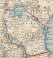
Fichier:Deutsch Ostafrika.PNG

Taille de cet aperçu : 550 × 599 pixels. Autres résolutions : 220 × 240 pixels | 440 × 480 pixels | 701 × 764 pixels.
Fichier d’origine (701 × 764 pixels, taille du fichier : 1,32 Mio, type MIME : image/png)
Historique du fichier
Cliquer sur une date et heure pour voir le fichier tel qu'il était à ce moment-là.
| Date et heure | Vignette | Dimensions | Utilisateur | Commentaire | |
|---|---|---|---|---|---|
| actuel | 8 juillet 2007 à 14:05 |  | 701 × 764 (1,32 Mio) | Ivan1111 | {{Information |Description= Map of German East Africa (March 1894) |Source= Brockhaus atlas (1894) |Date= March 1894 |Author= |Permission= |other_versions= }} |
Utilisation du fichier
La page suivante utilise ce fichier :
Usage global du fichier
Les autres wikis suivants utilisent ce fichier :
- Utilisation sur ca.wiki.x.io
- Utilisation sur en.wiki.x.io
- Utilisation sur es.wiki.x.io
- Utilisation sur fi.wiki.x.io
- Utilisation sur he.wiki.x.io
- Utilisation sur nl.wiki.x.io
- Utilisation sur ru.wiki.x.io
- Utilisation sur sw.wiki.x.io