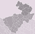
Fichier:Decin District 2010 names DC CZ.png

Taille de cet aperçu : 626 × 600 pixels. Autres résolutions : 251 × 240 pixels | 501 × 480 pixels | 930 × 891 pixels.
Fichier d’origine (930 × 891 pixels, taille du fichier : 93 kio, type MIME : image/png)
Historique du fichier
Cliquer sur une date et heure pour voir le fichier tel qu'il était à ce moment-là.
| Date et heure | Vignette | Dimensions | Utilisateur | Commentaire | |
|---|---|---|---|---|---|
| actuel | 2 mai 2010 à 23:33 |  | 930 × 891 (93 kio) | Miaow Miaow | typo |
| 2 mai 2010 à 23:01 |  | 930 × 891 (93 kio) | Miaow Miaow | {{Information |Description={{cs|Obce '''okresu Děčín''' dle stavu k 1. lednu 2010 (52 obcí). Bílé linie o různé tloušťce představují hranice obcí, správních obvodů, okresů, krajů a států.}} {{en|Municipalities of |
Utilisation du fichier
La page suivante utilise ce fichier :
Usage global du fichier
Les autres wikis suivants utilisent ce fichier :
- Utilisation sur azb.wiki.x.io
- Utilisation sur bg.wiki.x.io
- Utilisation sur cs.wiki.x.io
- Utilisation sur de.wiki.x.io
- Utilisation sur en.wiki.x.io
- Utilisation sur eo.wiki.x.io
- Utilisation sur fa.wiki.x.io
- Utilisation sur it.wiki.x.io
- Utilisation sur ko.wiki.x.io
- Utilisation sur ms.wiki.x.io
- Utilisation sur nl.wiki.x.io
- Utilisation sur pl.wiki.x.io
- Utilisation sur pt.wiki.x.io
- Utilisation sur ru.wiki.x.io
- Utilisation sur sk.wiki.x.io
- Utilisation sur ur.wiki.x.io
- Utilisation sur war.wiki.x.io
- Utilisation sur zh.wiki.x.io


