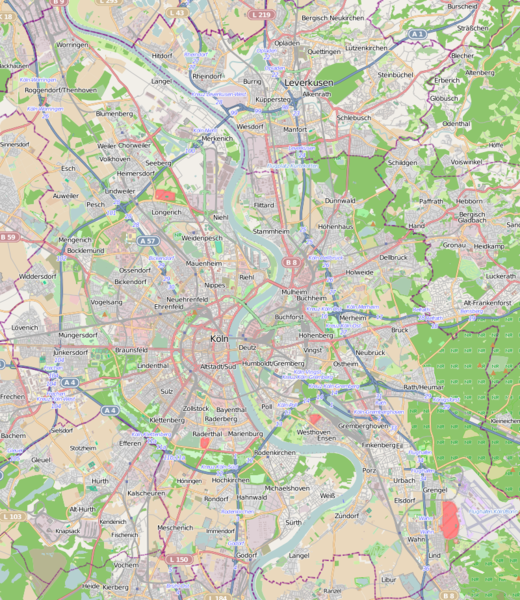
Fichier:Cologne location map.png

Taille de cet aperçu : 520 × 600 pixels. Autres résolutions : 208 × 240 pixels | 416 × 480 pixels.
Fichier d’origine (800 × 923 pixels, taille du fichier : 1,11 Mio, type MIME : image/png)
Historique du fichier
Cliquer sur une date et heure pour voir le fichier tel qu'il était à ce moment-là.
| Date et heure | Vignette | Dimensions | Utilisateur | Commentaire | |
|---|---|---|---|---|---|
| actuel | 28 mai 2013 à 19:43 |  | 800 × 923 (1,11 Mio) | Powerek38 | {{OpenStreetMap |name=Cologne |location=Cologne |description=Location map of Cologne, NRW, Germany |top=-51.085 |bottom=50.83 |left=6.809 |right=7.16 |date=2013-05-28 |authors= |other_versions= }} Category:Maps of Cologne |
Utilisation du fichier
Les 4 pages suivantes utilisent ce fichier :
Usage global du fichier
Les autres wikis suivants utilisent ce fichier :
- Utilisation sur eo.wiki.x.io
- Utilisation sur hu.wiki.x.io
- Utilisation sur hy.wiki.x.io
- Utilisation sur it.wiki.x.io
- Utilisation sur pl.wiki.x.io
- Museum Ludwig
- RheinEnergieStadion
- Katedra Kolońska
- Köln Hauptbahnhof
- Köln Messe/Deutz
- Köln Südbahnhof
- Köln West
- Kościół św. Pantaleona w Kolonii
- Kościół antonianów w Kolonii
- Köln Hansaring
- Kościół kartuzów w Kolonii
- Köln-Ehrenfeld (stacja kolejowa)
- Köln Trimbornstraße
- Köln-Nippes (stacja kolejowa)
- Köln-Geldernstraße/Parkgürtel
- Köln-Mülheim (stacja kolejowa)
- Köln-Volkhovener Weg
- Köln-Holweide (przystanek kolejowy)
- Köln-Buchforst (przystanek kolejowy)
- Köln-Dellbrück (stacja kolejowa)
- Köln-Longerich (stacja kolejowa)
- Köln-Stammheim (przystanek kolejowy)
- Wallraf-Richartz-Museum & Fondation Corboud
- Museum Schnütgen
- Kościół Najświętszej Marii Panny na Kapitolu w Kolonii
Voir davantage sur l’utilisation globale de ce fichier.
