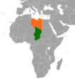
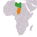
Fichier:Chad Libya Locator.png

Taille de cet aperçu : 528 × 600 pixels. Autres résolutions : 211 × 240 pixels | 422 × 480 pixels | 720 × 818 pixels.
Fichier d’origine (720 × 818 pixels, taille du fichier : 42 kio, type MIME : image/png)
Historique du fichier
Cliquer sur une date et heure pour voir le fichier tel qu'il était à ce moment-là.
| Date et heure | Vignette | Dimensions | Utilisateur | Commentaire | |
|---|---|---|---|---|---|
| actuel | 28 décembre 2020 à 18:16 |  | 720 × 818 (42 kio) | Aquintero82 | Updated map |
| 31 mars 2010 à 19:15 |  | 341 × 341 (8 kio) | Roxanna | Colours changed (actually Libya is the country with the green flag) | |
| 29 février 2008 à 01:12 |  | 341 × 341 (6 kio) | Calliopejen | {{Information |Description= Chad & Libya locator map |Source=based on Image:BlankMap-Africa.png |Date=2008-02-28 |Author=Calliopejen |Permission={{PD-self}} |other_versions= }} |
Utilisation du fichier
La page suivante utilise ce fichier :
Usage global du fichier
Les autres wikis suivants utilisent ce fichier :
- Utilisation sur ca.wiki.x.io
- Utilisation sur en.wiki.x.io
- Utilisation sur es.wiki.x.io
- Utilisation sur fa.wiki.x.io
- Utilisation sur ha.wiki.x.io
- Utilisation sur he.wiki.x.io
- Utilisation sur hr.wiki.x.io
- Utilisation sur it.wiki.x.io
- Utilisation sur pl.wiki.x.io
- Utilisation sur pt.wiki.x.io
- Utilisation sur ru.wiki.x.io
- Utilisation sur www.wikidata.org