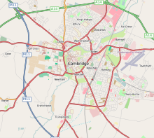
Fichier:Cambridge UK ward map 2010 coloured on Cambridge-Openstreetmap-08-06-13.svg

Taille de cet aperçu PNG pour ce fichier SVG : 600 × 600 pixels. Autres résolutions : 240 × 240 pixels | 480 × 480 pixels | 768 × 768 pixels | 1 024 × 1 024 pixels | 2 048 × 2 048 pixels.
Fichier d’origine (Fichier SVG, nominalement de 1 024 × 1 024 pixels, taille : 335 kio)
Historique du fichier
Cliquer sur une date et heure pour voir le fichier tel qu'il était à ce moment-là.
| Date et heure | Vignette | Dimensions | Utilisateur | Commentaire | |
|---|---|---|---|---|---|
| actuel | 8 septembre 2017 à 22:46 |  | 1 024 × 1 024 (335 kio) | Cmglee | Add postcode outward code boundaries. |
| 13 mai 2014 à 20:36 |  | 588 × 588 (334 kio) | Cmglee | Extend area to avoid truncating Trumpington, and brighten background. | |
| 21 avril 2014 à 17:13 |  | 575 × 575 (465 kio) | Cmglee | User created page with UploadWizard |
Utilisation du fichier
La page suivante utilise ce fichier :
Usage global du fichier
Les autres wikis suivants utilisent ce fichier :
- Utilisation sur azb.wiki.x.io
- Utilisation sur de.wiki.x.io
- Utilisation sur en.wiki.x.io
- Utilisation sur hy.wiki.x.io
- Utilisation sur it.wiki.x.io
- Utilisation sur pl.wiki.x.io
- Utilisation sur ru.wiki.x.io
- Utilisation sur sl.wiki.x.io

