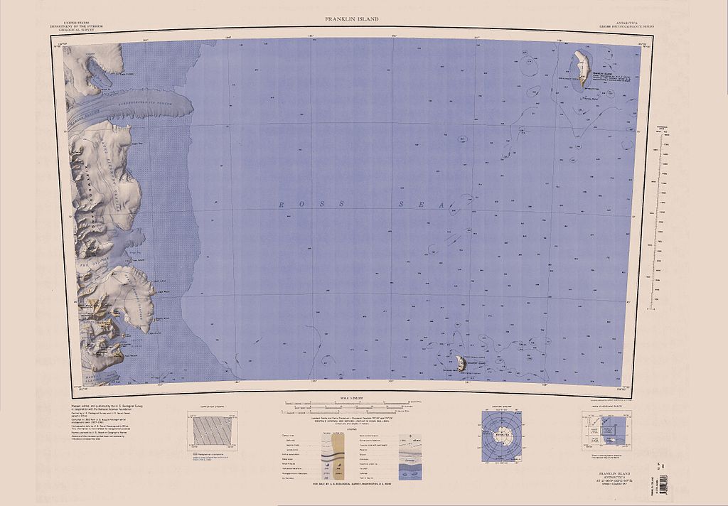
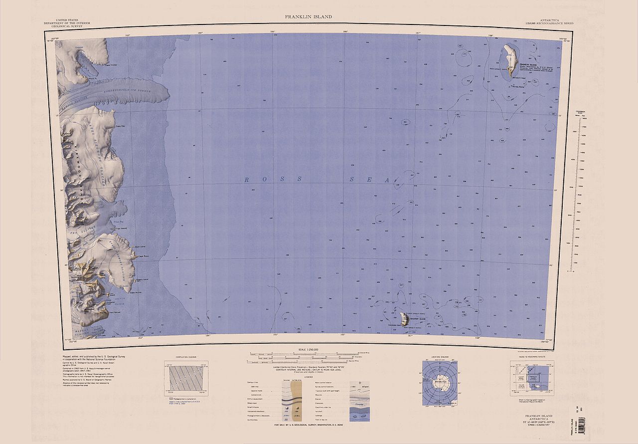
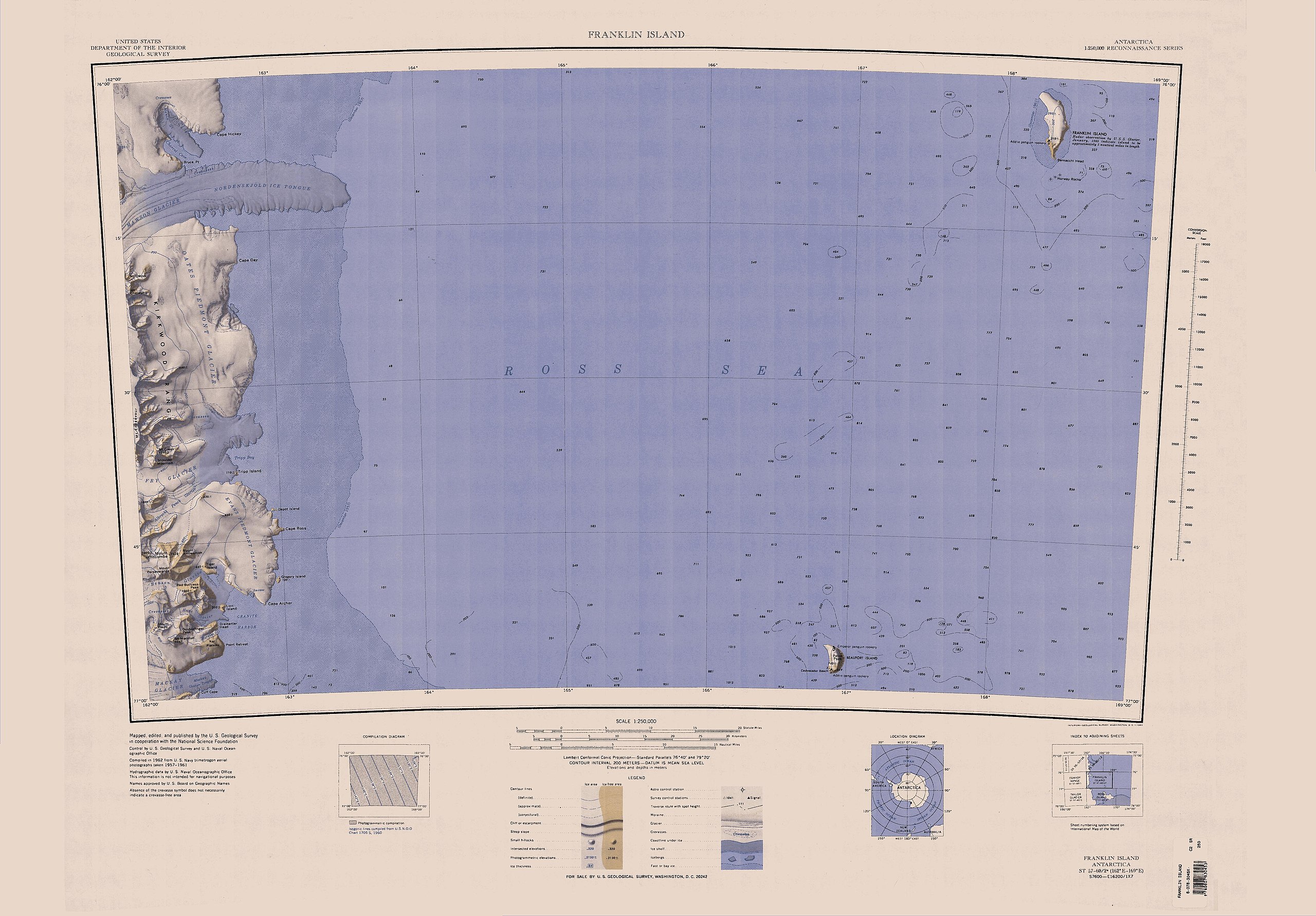
Fichier:C76191s1 Ant.Map Franklin Island.jpg

Taille de cet aperçu : 800 × 556 pixels. Autres résolutions : 320 × 223 pixels | 640 × 445 pixels | 1 024 × 712 pixels | 1 280 × 890 pixels | 2 560 × 1 781 pixels | 4 678 × 3 254 pixels.
Fichier d’origine (4 678 × 3 254 pixels, taille du fichier : 1,48 Mio, type MIME : image/jpeg)
Ce fichier et sa description proviennent de Wikimedia Commons.
| Description |
English: Map of Antarctica by the United States Antarctic Resource Center of the US Geological Society. |
| Source | USGS |
| Auteur | USGS |
Cette image est placée dans le domaine public parce qu'elle contient des éléments issus de l'United States Geological Survey, une agence du Département de l'Intérieur des États-Unis. Pour plus d'information, consultez la politique officielle de copyright de l'USGS (en anglais)
|
Historique du fichier
Cliquer sur une date et heure pour voir le fichier tel qu'il était à ce moment-là.
| Date et heure | Vignette | Dimensions | Utilisateur | Commentaire | |
|---|---|---|---|---|---|
| actuel | 3 avril 2005 à 22:43 | | 4 678 × 3 254 (1,48 Mio) | Achim Raschka | Map of Antarctica by the United States Antarctic Ressource Center of the US Geological Society. {{PD-US}} Copyrights and Trademarks USGS-authored or produced data and information are in the public domain. While the content of most USGS web pages is in th |
Utilisation du fichier
La page suivante utilise ce fichier :
Usage global du fichier
Les autres wikis suivants utilisent ce fichier :
- Utilisation sur bg.wiki.x.io
- Utilisation sur ceb.wiki.x.io
- Utilisation sur de.wiki.x.io
- Utilisation sur en.wiki.x.io
- Utilisation sur it.wiki.x.io
- Utilisation sur nds.wiki.x.io
- Utilisation sur no.wiki.x.io
- Utilisation sur www.wikidata.org