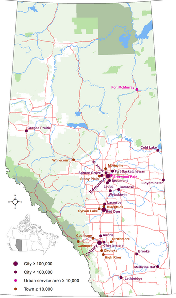
Fichier:Alberta's Cities.png

Taille de cet aperçu : 355 × 600 pixels. Autres résolutions : 142 × 240 pixels | 284 × 480 pixels | 454 × 768 pixels | 606 × 1 024 pixels | 1 741 × 2 941 pixels.
Fichier d’origine (1 741 × 2 941 pixels, taille du fichier : 298 kio, type MIME : image/png)
Historique du fichier
Cliquer sur une date et heure pour voir le fichier tel qu'il était à ce moment-là.
| Date et heure | Vignette | Dimensions | Utilisateur | Commentaire | |
|---|---|---|---|---|---|
| actuel | 25 octobre 2020 à 01:07 |  | 1 741 × 2 941 (298 kio) | Hwy43 | Update to show Morinville is now eligible for city status with a population greater than 10,000. |
| 2 janvier 2019 à 07:49 |  | 1 741 × 2 941 (280 kio) | Hwy43 | uploading again (accidentally uploaded an updated towns map instead) | |
| 2 janvier 2019 à 07:46 |  | 1 741 × 2 941 (262 kio) | Hwy43 | Update to reflect Beaumont's change to city status and the Town of Blackfalds surpassing the city status minimum population threshold in its 2018 municipal census | |
| 27 décembre 2014 à 10:08 |  | 2 321 × 3 921 (392 kio) | Hwy43 | updated to reflect Chestermere's change from town status to city status effective January 1, 2015 | |
| 19 juillet 2013 à 07:07 |  | 1 741 × 2 941 (277 kio) | Hwy43 | User created page with UploadWizard |
Utilisation du fichier
Les 2 pages suivantes utilisent ce fichier :
Usage global du fichier
Les autres wikis suivants utilisent ce fichier :
- Utilisation sur azb.wiki.x.io
- Utilisation sur en.wiki.x.io
- Utilisation sur is.wiki.x.io
- Utilisation sur zh.wiki.x.io