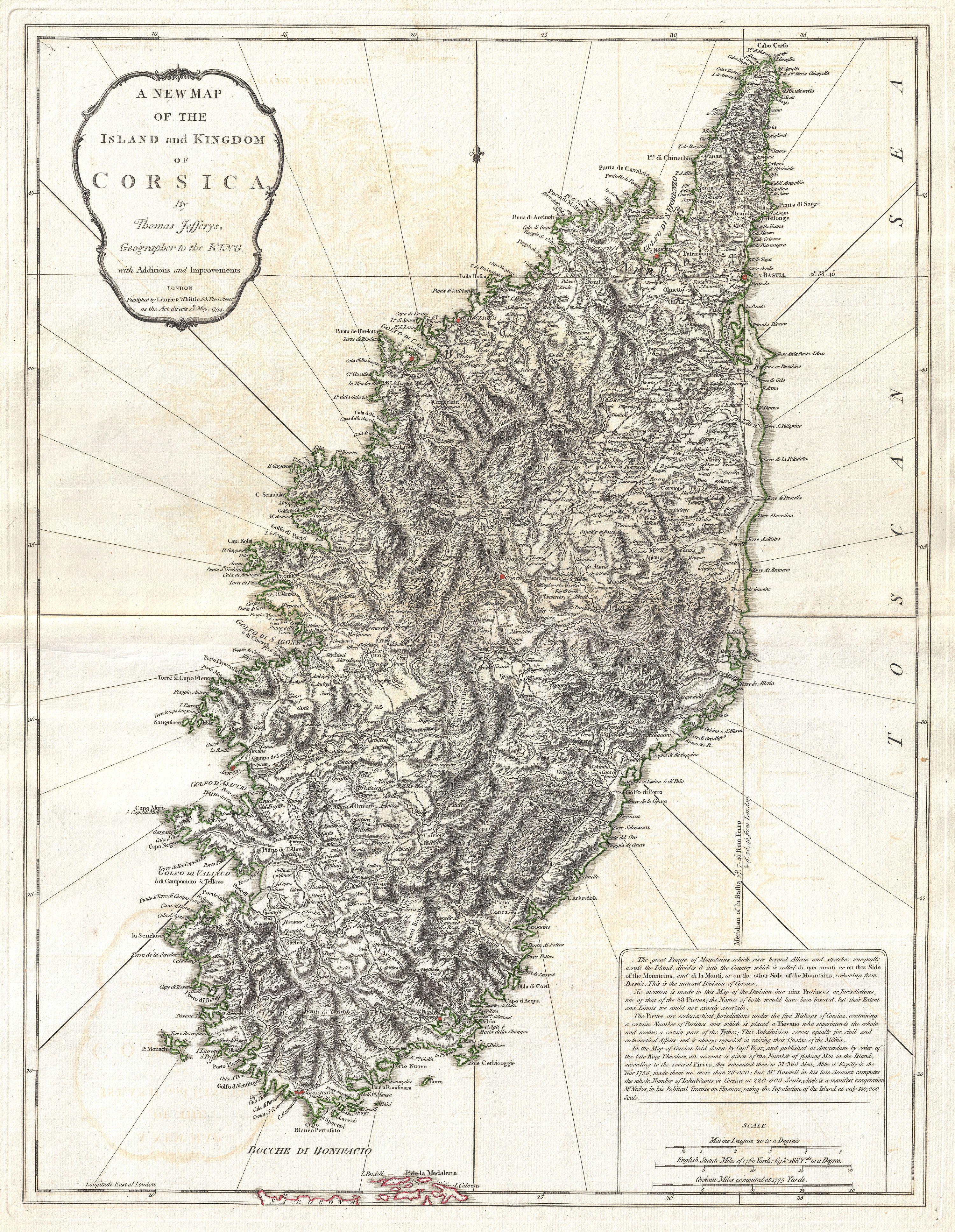
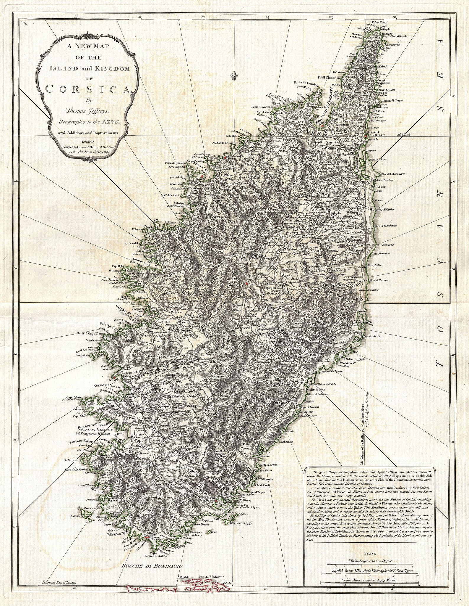
Fichier:1794 Jeffreys Map of Corsica, France - Geographicus - Corsica-jeffreys-1794.jpg
Fichier d’origine (3 000 × 3 870 pixels, taille du fichier : 3,17 Mio, type MIME : image/jpeg)
Ce fichier et sa description proviennent de Wikimedia Commons.
| A New Map of the Island and Kingdom of Corsica. | ||||||
|---|---|---|---|---|---|---|
| Artiste | ||||||
| Titre |
A New Map of the Island and Kingdom of Corsica. |
|||||
| Description |
English: An extraordinary 1794 map of the Island and Kingdom of Corsica. Covers the entire island in extraordinary detail offering both topographical and political information. With its unique blend of dramatic mountains and stunning pristine beaches, Corsica is considered to be one of the world's most beautiful places. A note in the lower right hand quadrant discusses the geography and population of the island. Prepared by Thomas Jefferys and published by Laurie & Whittle in Kitchin's 1794 General Atlas . |
|||||
| Date | 1794 (dated) | |||||
| Dimensions | hauteur : 25,5 pouces (64,7 cm) ; largeur : 19,5 pouces (49,5 cm) | |||||
| Numéro d’inventaire |
liens Geographicus : Corsica-jeffreys-1794 |
|||||
| Source / photographe |
Kitchin, Thomas, Kitchin's General Atlas, describing the Whole Universe: being a complete collection of the most approved maps extant; corrected with the greatest care, and augmented from the last edition of D'Anville and Robert with many improvements by other eminent geographers, engraved on Sixty-Two plates, comprising Thirty Seven maps., Laurie & Whittle, London, 1797.
|
|||||
| Autorisation (Réutilisation de ce fichier) |
|
|||||
Historique du fichier
Cliquer sur une date et heure pour voir le fichier tel qu'il était à ce moment-là.
| Date et heure | Vignette | Dimensions | Utilisateur | Commentaire | |
|---|---|---|---|---|---|
| actuel | 23 mars 2011 à 06:29 | | 3 000 × 3 870 (3,17 Mio) | BotMultichillT | {{subst:User:Multichill/Geographicus |link=http://www.geographicus.com/P/AntiqueMap/Corsica-jeffreys-1794 |product_name=1794 Jeffreys Map of Corsica, France |map_title=A New Map of the Island and Kingdom of Corsica. |description=An extraordinary 1794 map |
Utilisation du fichier
Les 2 pages suivantes utilisent ce fichier :
Usage global du fichier
Les autres wikis suivants utilisent ce fichier :
- Utilisation sur ca.wiki.x.io
- Utilisation sur co.wiki.x.io
- Utilisation sur de.wiki.x.io
- Utilisation sur en.wiki.x.io
- Utilisation sur es.wiki.x.io
- Utilisation sur he.wiki.x.io
- Utilisation sur hu.wiki.x.io
- Utilisation sur id.wiki.x.io
- Utilisation sur it.wiki.x.io
- Utilisation sur nap.wiki.x.io
- Utilisation sur pt.wiki.x.io
- Utilisation sur ru.wiki.x.io
- Utilisation sur sh.wiki.x.io
- Utilisation sur sr.wiki.x.io
- Utilisation sur sv.wiki.x.io
- Utilisation sur uk.wiki.x.io
- Utilisation sur vi.wiki.x.io
- Utilisation sur www.wikidata.org
- Utilisation sur zh.wiki.x.io