Division de Kumaon
division administrative de l'Uttarakhand
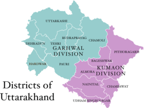
La Division de Kumaon (simplement Kumaon, hindi : कुमाऊँ, API : /kumɑːũː/) est l'une des 2 divisions administratives de l'État indien de l'Uttarakhand (l'autre étant le Garhwal). Elle correspond à la région historique du même nom, issue de l'ancien royaume de Kumaon.
| Division de Kumaon | ||
| Administration | ||
|---|---|---|
| Pays | ||
| État | Uttarakhand | |
| Chef-lieu | Nainital | |
| Fuseau horaire | IST (UTC+5:30) | |
| Démographie | ||
| Population | 4 668 329 hab. (2001) | |
| Densité | 222 hab./km2 | |
| Géographie | ||
| Coordonnées | 29° 36′ nord, 79° 42′ est | |
| Superficie | 2 105 600 ha = 21 056 km2 | |
| Localisation | ||

| ||
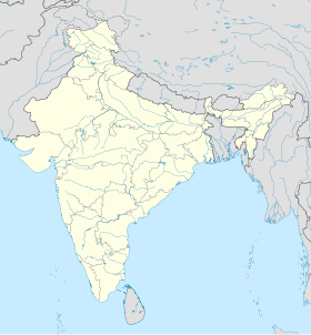
| Géolocalisation sur la carte : Inde
| ||
| Liens | ||
| Site web | kumaon.gov.in | |
| modifier |
||
Il est constitué de 6 districts :
Voici un tableau montrant la population et la superficie de chaque district :
| District | Anglais | Superficie (km²) | Population (en 2001) | Capitale
|
| Pithoragarh | Pithoragarh | 7,110 | 485,993 | Pithoragarh |
| Bageshwar | Bageshwar | 1,781 | 224,542 | Bageshwar |
| Almora | Almora | 3,082 | 630,567 | Almora |
| Champawat | Champawat | 2,302 | 249,462 | Champawat |
| Nainital | Nainital | 3,860 | 955,128 | Nainital |
| Udham Singh Nagar | Udham Singh Nagar (en) | 2,908 | 1,235,614 | Rudrapur |
