Amphoe Chanuman
amphoe (district) de Amnat Charoen, Thaïlande
Chanuman (ชานุมาน) est un district (amphoe) situé dans la province d'Amnat Charoen[1], dans le nord-est de la Thaïlande. Le district est divisé en 5 tambon et 59 muban. Il comprenait plus de 37,677 habitants en 2005[2].
| Chanuman ชานุมาน | |
| Administration | |
|---|---|
| Pays | |
| Province | Amnat Charoen |
| Tambon | 5 |
| Muban | 59 |
| Démographie | |
| Population | 37 667 hab. (2005) |
| Géographie | |
| Coordonnées | 16° 14′ 00″ nord, 105° 00′ 00″ est |
| Localisation | |
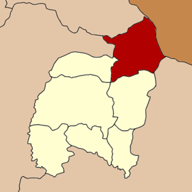
 Localisation du district. | |
| modifier |
|
Histoire
modifierMueang Chanuman Monthon a été créé en 1879[3], à l'époque en tant que partie intégrante du Monthon Ubon Ratchathani. Plus tard, la ville a dû faire face à une crise économique et une partie de la population a émigré vers d'autres régions. Le prince Sapphasitthiprasong déclasse Chanuman en catégorie king amphoe et le subordonne en catégorie amphoe khemarat[4]. En 1958, Chanuman retrouve son statut d'Amphoe[5]. Chanuman a été l'un des districts avec lesquels la nouvelle province Amnat Charoen a été formée le .
Personnalités liées
modifier- Am Chonthicha, chanteuse thaïlandaise
Notes et références
modifier- (th) « th:พัฒนาการทางประวัติศาสตร์ », Ministry of Defense
- « Einwohnerstatistik 2013 », Department of Provincial Administration (consulté le ).
- (th) « Ministry of Defense » (consulté le ).
- (th) « แจ้งความกระทรวงมหาดไทย เรื่อง เลิกและยุบอำเภอต่างๆ ในมณฑลอุบลลงเป็นกิ่งอำเภอ », Royal Gazette, vol. 29, no 0 ง, , p. 982–983 (lire en ligne).
- (th) « พระราชกฤษฎีกาจัดตั้งอำเภอกระสัง อำเภอกระนวน อำเภอบางกอกใหญ่ อำเภอขุนหาร อำเภอพนา อำเภอปากช่อง อำเภอวังเหนือ อำเภอวังชิ้น อำเภอแม่ทา อำเภอหนองหมู อำเภอสระแก้ว อำเภออมก๋อย อำเภอบางซ้าย อำเภอทับสะแก อำเภอบุณฑริก อำเภอลานสะกา อำเภอจอมบึง อำเภอท่ายาง อำเภอสามเงา อำเภอฟากท่า อำเภอบ้านเขว้า อำเภอชานุมาน อำเภอแม่พริก อำเภอท่าสองยาง อำเภอสะเมิง อำเภอหนองแขม อำเภอพระแสง พ.ศ. ๒๕๐๑ », sur Royal Gazette, p. 321–327.